1

After receiving and answer to this question, I am stuck with another problem.

For context, my end goal is to assess windward/lee side of a forested edges (line segments) in respect to a dominant wind direction. Following the answer in the linked question, I have created an offset point on the inside edge of each line segment. I now am trying to evaluate these line segments based on the azimuth of the offset (segment midpoint to offset midpoint).

How can I reference the offset point in an expression in a field calculation on the original line segment?


How do I reference offset_point if it is in another layer?

If it is another feature in the same layer?

psuedocode: 
offset_azimuth = degrees(azimuth(segment_midpoint, offset_point))
if(offset_azimuth = (windDir +/- 45), "Lee", "Windward")

1 Answer 1

1

If I understood your question right, the azimuth you're looking for is the azimuth of the small red lines in the original answer. I created this line using the following expression on the layer with the resulting points (those inside the polygons). It includes the overlay_nearest function, available since QGIS 3.16. The first argument is the reference to a layer - in my case named 'exploded' - rename it for the name of the layer you use:

shortest_line (
    centroid (
        array_first( 
            overlay_nearest( 
                'exploded', 
                $geometry
            )
        )
    ), 
    $geometry
)

You can get the azimuth of this line using the function azimuth(point_a,point_b), where point_a is the start- and point_b the endpoint of the line created above. To avoid repeating the whole expression from above, add the function with_variable(name,value,expression) to define the line as a custom variable @line that you than can use with start_point (@line) and end_point (@line).

Finally, the azimuth function retunrns the azimuth in radians - you probably want to convert it to degrees, so convert the whole expression with the function degrees(radians).

The final expression looks like this:

degrees( 
    with_variable( 
        'line',
        shortest_line (
            centroid (
                array_first( 
                    overlay_nearest( 
                        'exploded', 
                        $geometry
                    )
                )
            ), 
            $geometry
        ),
        azimuth (
            end_point (@line),
            start_point (@line)
        )
    )
)

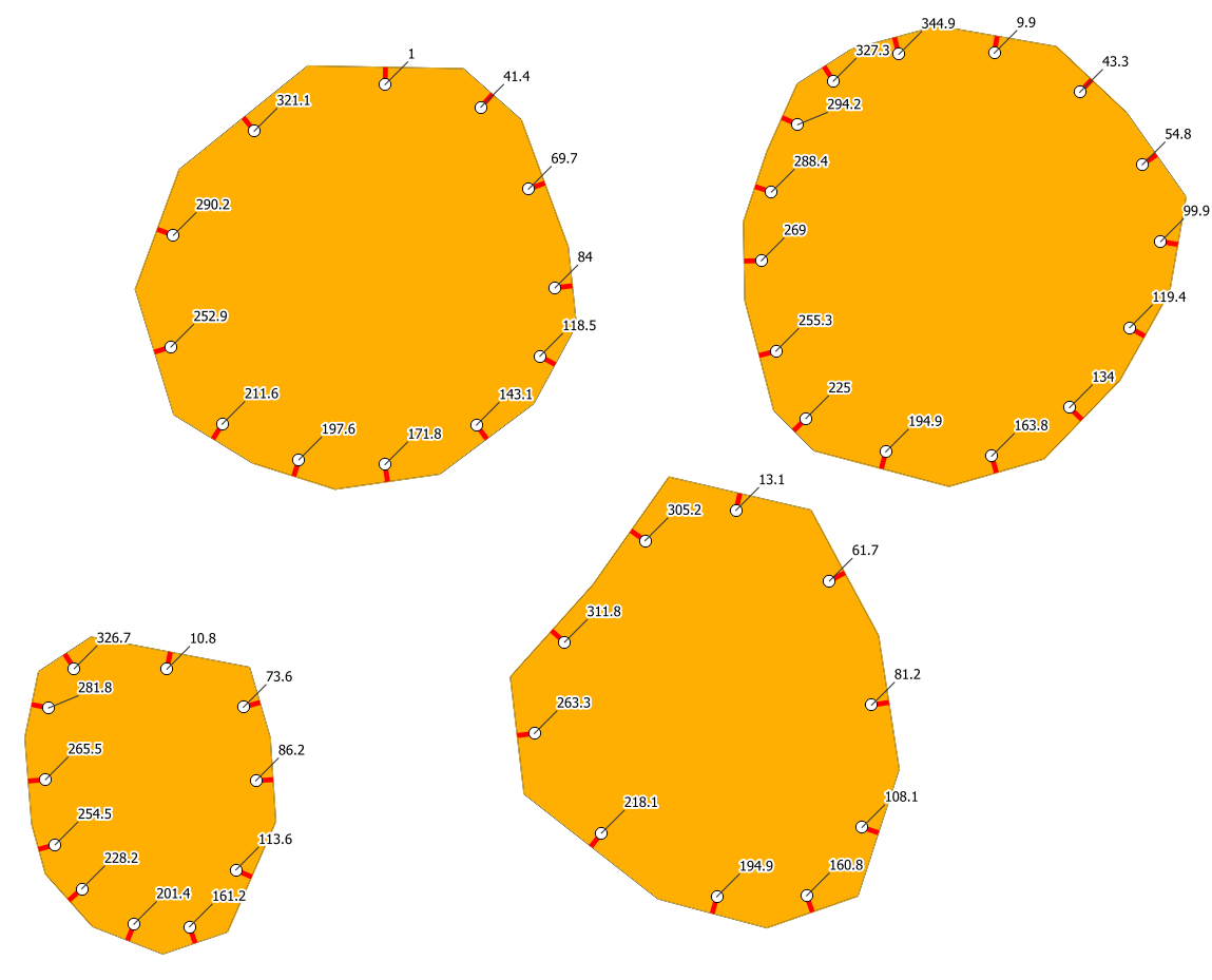
Here is how the degree is calculated: I used the expression from above to define a label (I added a round function to round it to one decimal):

enter image description here

1
  • how do I integrate this into a graphical model? I don't know how to reference a algorithm output in place of 'exploded'
    – hadallen
    Commented Feb 28, 2021 at 21:02

Your Answer

By clicking “Post Your Answer”, you agree to our terms of service and acknowledge you have read our privacy policy.

Not the answer you're looking for? Browse other questions tagged or ask your own question.