My question is in regards to the answer given to Georeference single drone image from EXIF data.
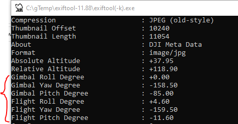
The answer describes how to georeference a single drone (DJI) image using EXIF data but, in the solution they present, why do they use the Gimbal angle for Pitch but the Flight Angle for Yaw i.e. what is the difference between Gimbal and Flight angles? From what I gather, the flight angle is in the world coordinate system and the gimbal angle is in a coordinate relative to body of the drone. With that said, the documentation is very confusing and forum discussions I have seen on this topic often have conflicting information.
Ultimately, I need to solve for the absolute orientation of the CAMERA. In other words, where is the camera pointing in the world frame. To do so, I need to know the specific flight and gimbal coordinate system which Is unclear.
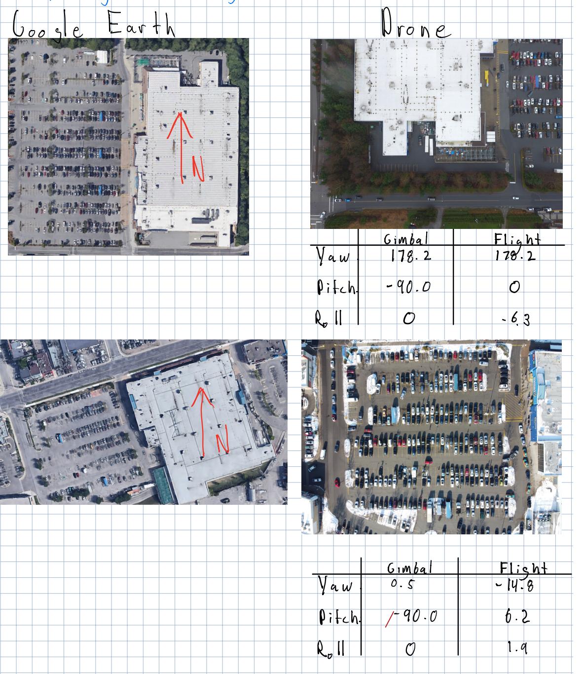
Here is some preliminary work I have done to try to figure out what Flight vs Gimbal Angle is in DJI drones. I have extracted an image from google earth so I am able to verify the yaw orientation of the drone (left pictures). I indicate the north direction with a red arrow. The pictures on the right are the image of the corresponding location from the images shot with a drone. (They are usually a sub-component of the image to the left). In any event, with this information, I am trying to make sense of the flight and gimbal angles, specifically the yaw.
(Top Image DJI Phantom 4 and DJI Mavic Mini Bottom Image)
As you can see in the top image, the flight and yaw angles are equivalent. However, it makes no sense to me because the gimbal angle should relative to the body of the drone but this is not the case because both gimbal and flight angles are nearly 180 degrees but the camera heading in the drone image is south instead of north.
In the bottom example, the angles make more sense according to my understanding but the first example makes me think I have it all wrong.


