1

Background:

Our local newspaper contained this link to some upcoming forest management activity in the area:

https://usfs.maps.arcgis.com/apps/webappviewer/index.html?id=021ff3371f584a54beb15cd481a8fbb5

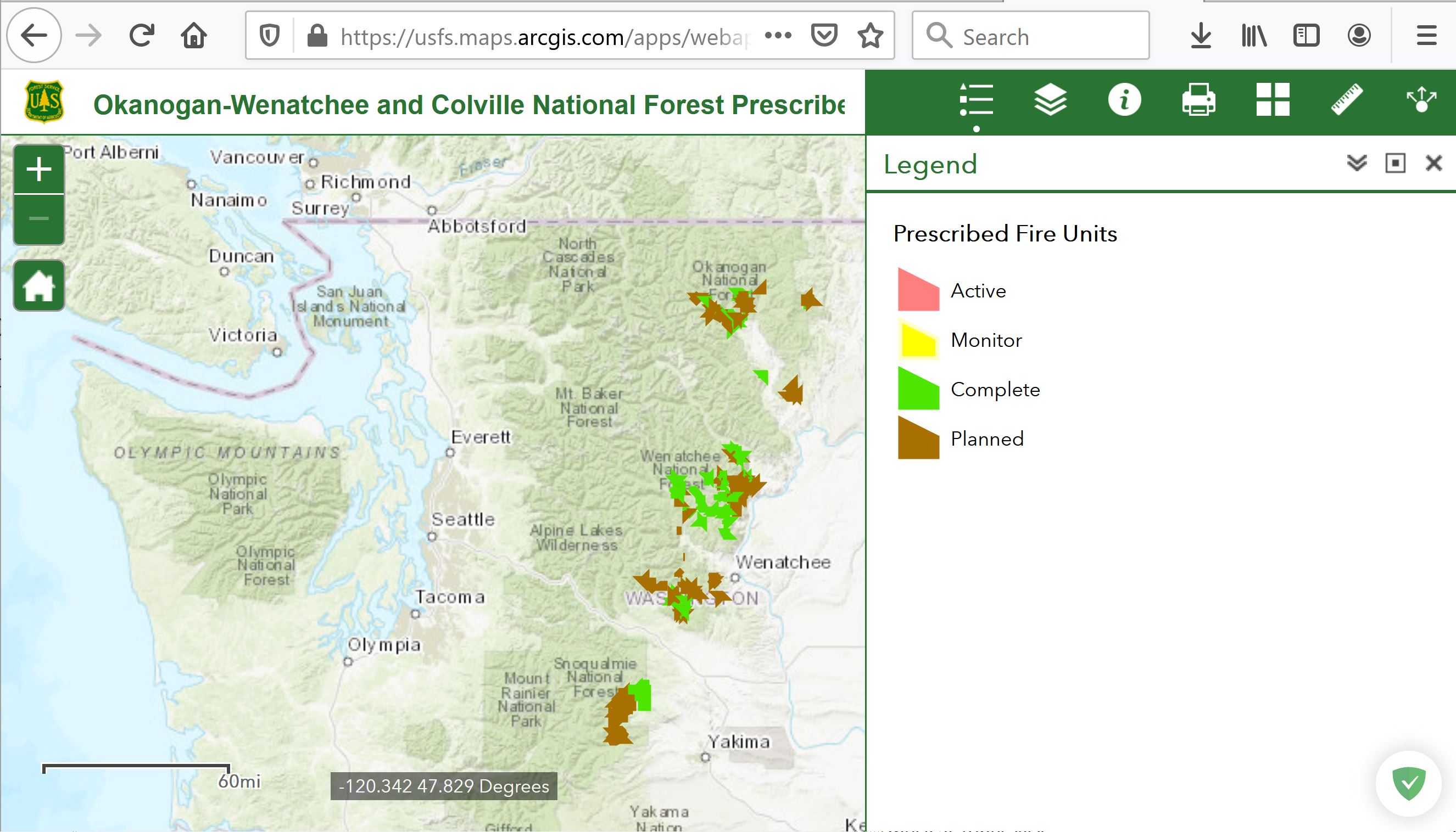
Here's a screenshot of the resulting argis.com webmap:

enter image description here

Problem:

I would like access the prescribed fire polygon layer displayed in this webmap, either as a service or via download. However, I'm unable to accomplish this seemingly simple task. Here's what I've unsuccessfully tried:

  1. Look for some sort of link (service url or layer download) in the webmap itself
  2. Search for the polygon layer via my personal arcgis.com account. Here my steps were to create a new map and search using Add > Search for Layers, Add > Browse Living Atlas Layers, and Add > Add Layer From Web.
  3. From ArcMap (10.8.1), Add > Add Data from ArcGIS Online and search

Question:

How do I access the polygon layer in this webmap?

3
  • 1
    you can inspect the network traffic, and when you get a layer URL you can browse up to all other layers: services1.arcgis.com/gGHDlz6USftL5Pau/ArcGIS/rest/services (whether you are permitted or not to use these layers is another question though...)
    – JGH
    Commented Mar 29, 2021 at 18:22
  • @JGH I can view the layers in the link you provided. However, I could not find the layer from my OP. Also, how does one "...inspect network traffic..."?
    – Stu Smith
    Commented Mar 29, 2021 at 19:50
  • 1
    check the layers starting with "OKW", maybe. Look at the developer tools of your favorite browser, they typically have a network tab (right click in a webpage, inspect/dev tools, network)
    – JGH
    Commented Mar 29, 2021 at 19:55

1 Answer 1

0

To get the data in GeoJSON use the long url

https://services1.arcgis.com/gGHDlz6USftL5Pau/ArcGIS/rest/services/OKW_2017RXFireUnitPolys_VIEW/FeatureServer/0/query?where=1%3D1&objectIds=&time=&geometry=&geometryType=esriGeometryEnvelope&inSR=4326&spatialRel=esriSpatialRelIntersects&resultType=none&distance=0.0&units=esriSRUnit_Meter&returnGeodetic=false&outFields=*&returnGeometry=true&returnCentroid=false&featureEncoding=esriDefault&multipatchOption=xyFootprint&maxAllowableOffset=&geometryPrecision=&outSR=&datumTransformation=&applyVCSProjection=false&returnIdsOnly=false&returnUniqueIdsOnly=false&returnCountOnly=false&returnExtentOnly=false&returnQueryGeometry=false&returnDistinctValues=false&cacheHint=false&orderByFields=&groupByFieldsForStatistics=&outStatistics=&having=&resultOffset=&resultRecordCount=&returnZ=false&returnM=false&returnExceededLimitFeatures=true&quantizationParameters=&sqlFormat=none&f=pgeojson&token=

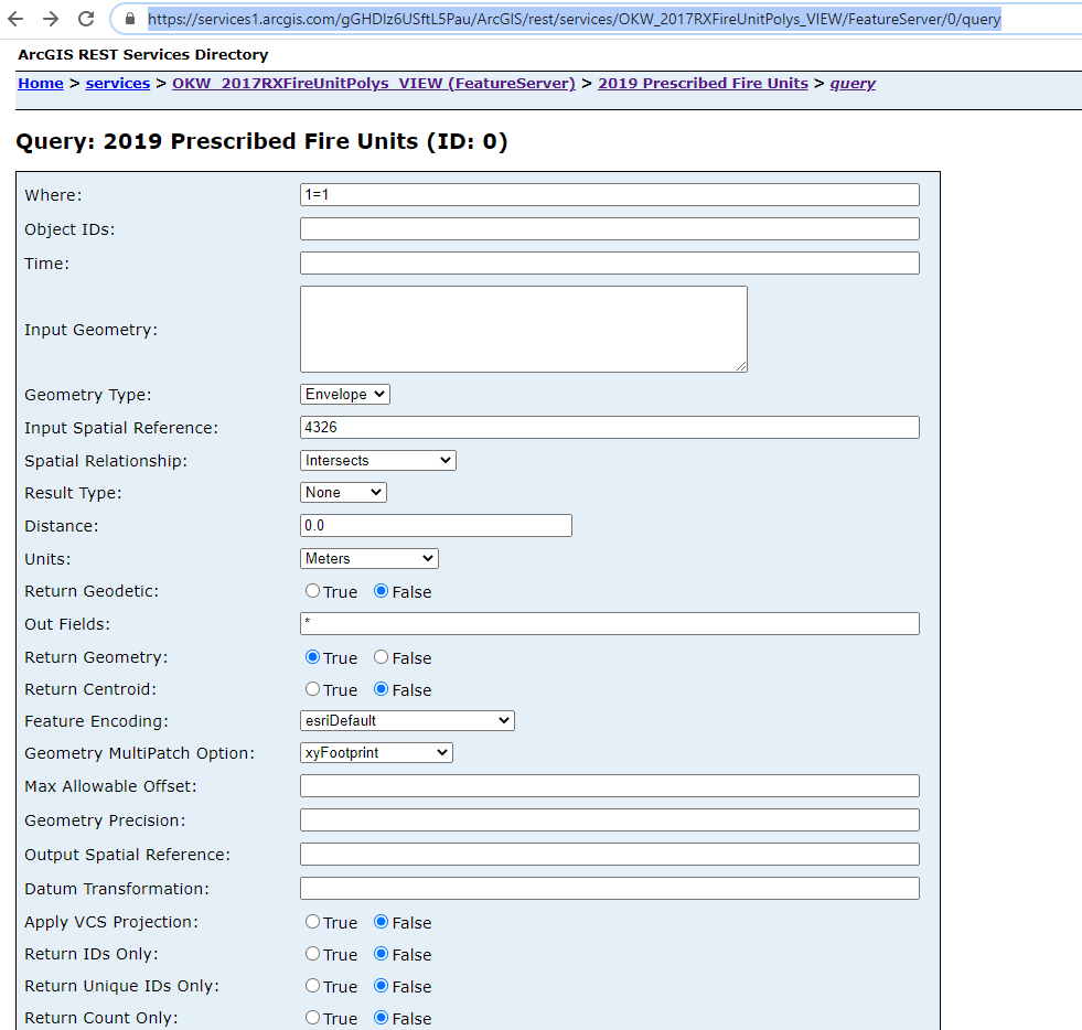
This can be done from the query wizard here https://services1.arcgis.com/gGHDlz6USftL5Pau/ArcGIS/rest/services/OKW_2017RXFireUnitPolys_VIEW/FeatureServer/0/query

enter image description here

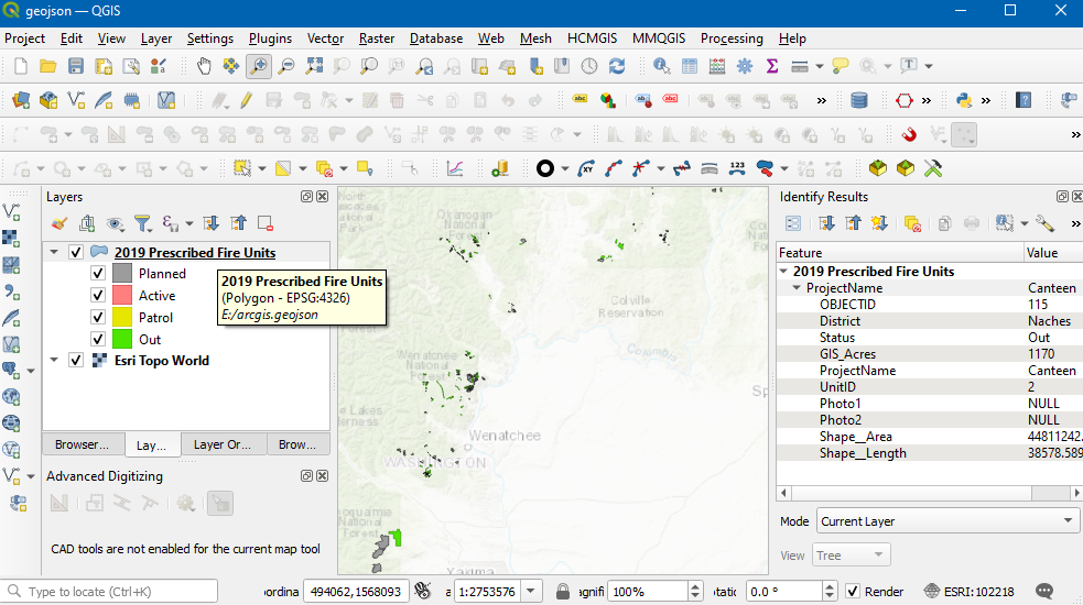
(in QGIS this will load with drag and drop) but your looking for ArcGIS. When in the Office next year can validate. screenshot shows the data in geojson/styled as the map legend. enter image description here

Your Answer

By clicking “Post Your Answer”, you agree to our terms of service and acknowledge you have read our privacy policy.

Not the answer you're looking for? Browse other questions tagged or ask your own question.