I’m using QGIS to map satellite imagery imported via the SentinelHub plugin. I’ve added a layer pinpointing active fires globally, which works fine over the satellite imagery. So far so good. Now I’d like to add labels and borders to better situate fires, say, currently in Turkey. When I import an Open Street Map layer, I of course have to place it over the satellite imagery for it to appear, at which point the sat imagery disappears. What I need is an Open Street Map tile type layer that only includes borders and labels that I can place over the satellite layer.
-
You can check QGIS/OpenLayers-How to add a labels-only reference layer– PadmanabhaCommented Aug 5, 2021 at 3:18
-
If you sign up for Mapzen api key vector tiles you can use layers you require from OSM mapzen.com/products/maps/bubble-wrap/…– Mapperz ♦Commented Aug 5, 2021 at 3:53
-
you could also download the turkey border as a vector layer on the GADM website– Pierrick RambaudCommented Aug 5, 2021 at 7:34
2 Answers
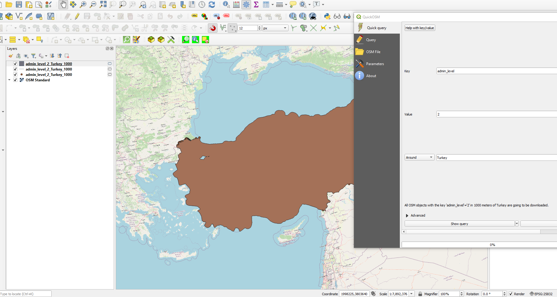
The reason why your satellite image disapears is that both of your layers (OSM and Sentinel) are raster layers - for borders etc. vector layers are much better. You can obtain vector layers from OpenStreetMap via the QuickOSM Plugin for QGIS - the plugin is self explaining, all you need to know is the right tags for the OSM data. You can find help for the right tags here: https://wiki.openstreetmap.org/wiki/Tags
For country borders around turkey the query would be: admin_level=2. See my example:
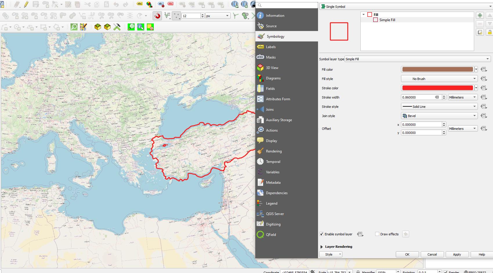
Now, depending on your further analysis you are planning to do remove the polygon and point layer (so only the line layer representing the border is left). If you want to use the country as mask layer for further analysis you should remove all but the polygon and just style it so that there is no color shown filling the polygon (right click on the layer -> properties -> symbology)
-
Thanks so much for taking the time. Giving this a go. Commented Aug 13, 2021 at 20:21
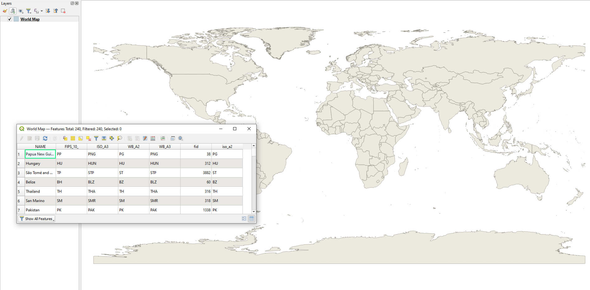
As an alternative for obtaining borders can be achieved with a QGIS's Easter egg, i.e. world.
By simply typing world in the 'Coordinate' box
a vector 'World Map' with its attribute table will appear in the Layers tab
It includes "NAME" field (probably can be used for labeling).
Then apply setting offered by @sn1ks in his answer.
More information about QGIS's Easter eggs can be found in: Where to find all hidden layers/effects in QGIS?


