I am trying to understand the setting of ratio in ol.source.ImageWMS but I am not succeeding. I already understand the ratio: 1, as there is not much to understand there. ratio: 1 = browser viewbox. I also understand the principle of ratio: 2.
Ratio. 1 means image requests are the size of the map viewport, 2 means twice the width and height of the map viewport, and so on. Must be 1 or higher.
The Data of a BBOX is sent in the URL-querystring at the server request. But it seems that these are not the coordinates of the BBOX from the ratio. Or is it? If no, then I ask how the data of the ratio BBOX can be calculated?
What I need is the data for cropping. So far I had no success to calculate them.
This calculation does not provide the correct data for cropping:
var ImageWMS_ratio = 2; // range 1 - 2

var mapsize_width = map.getSize()[0];
var mapsize_height = map.getSize()[1];

var mapsize_width_ratio = (mapsize_width * (ImageWMS_ratio - 1));
var mapsize_height_ratio = (mapsize_height * (ImageWMS_ratio - 1));

/*
// In this example without if() rules.
// The if() rules are calculated with the BBOX data from the URL-Querystring and map.getPixelFromCoordinate([]);
// If a Image edge outside the BBOX, then cropping, otherwise = 0.
*/
var left_crop = (mapsize_width_ratio * -1);
var bottom_crop = (mapsize_height + mapsize_height_ratio);
var right_crop = (mapsize_width + mapsize_width_ratio);
var top_crop = (mapsize_height_ratio * -1);
Note: For all those who think that the WMS calculates this: No WMS is used. The cropping data is needed.
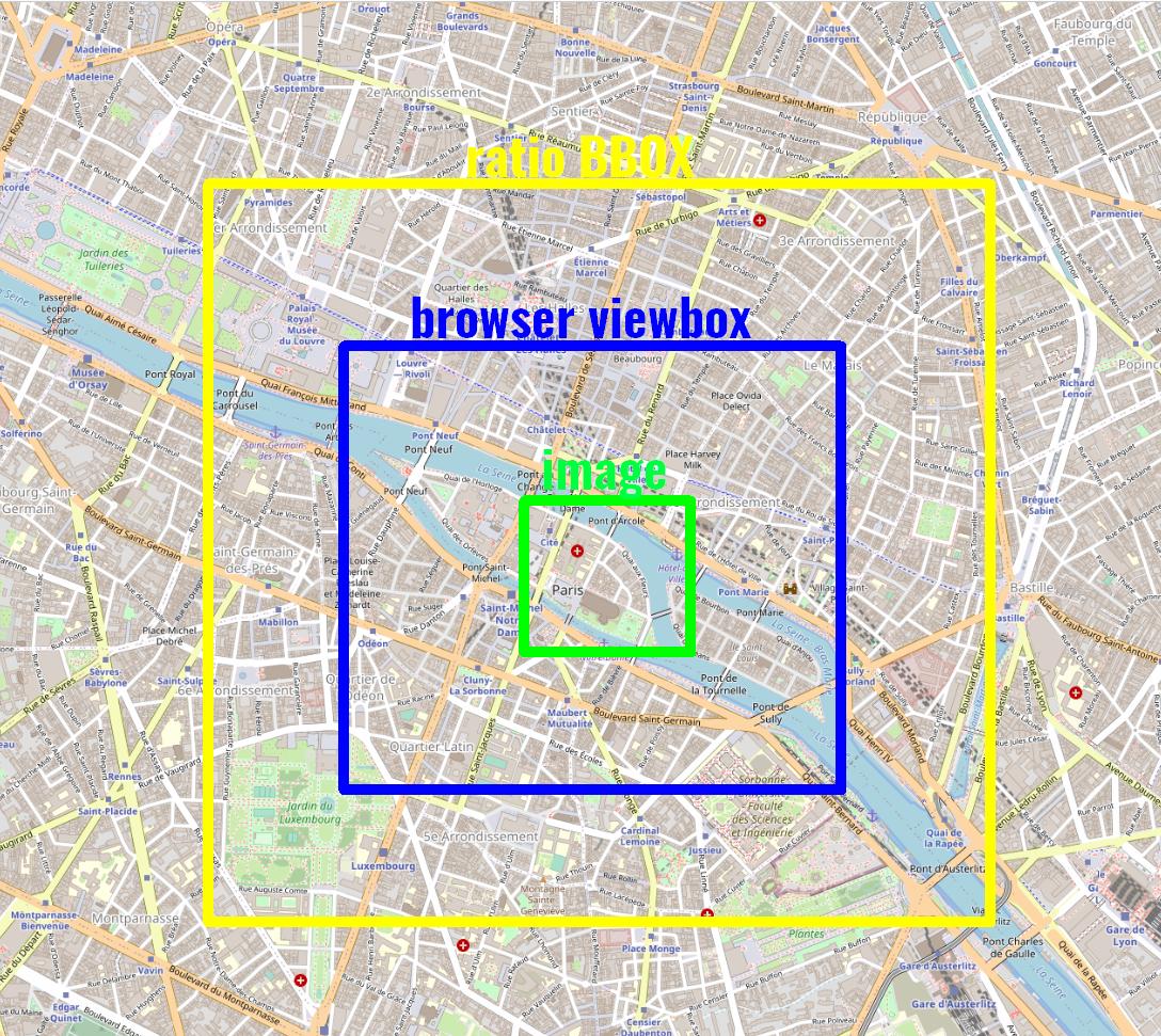
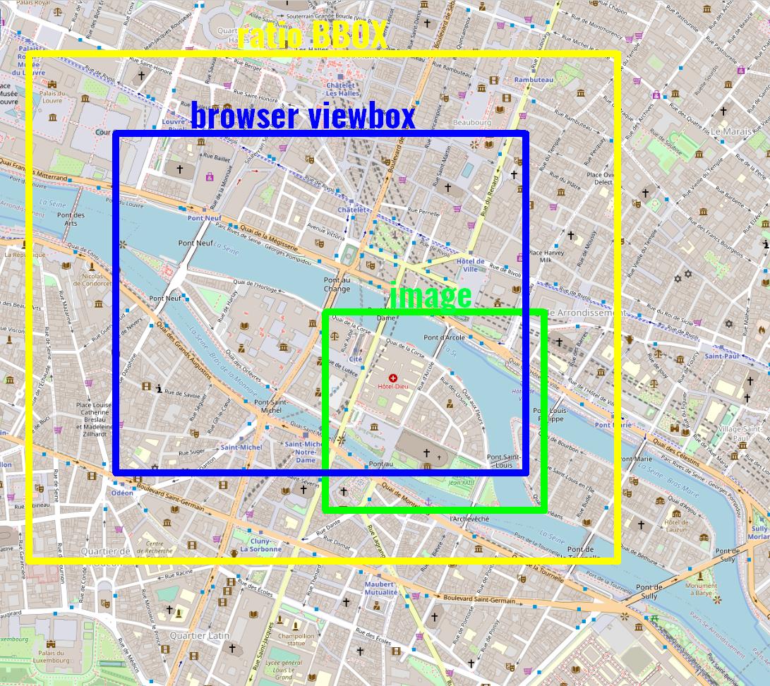
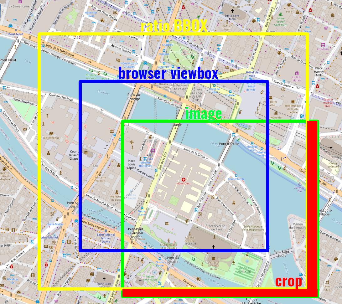
Here are three graphics that clarify the whole thing. I visualized it with a ratio greater than 1 and in 3 zoom levels.
Picture 1: The image is inside the browser viewbox.
Picture 2: The image is outside the browser viewbox and inside the ratio BBOX (i think).
Picture 3: The image is outside the browser viewbox and outside the ratio BBOX (i think). Cropping is necessary.


ratio:1, but had problems with ratio greater 1, also already without cropping. I don't understand the logic of ratio greater 1. First also i will understand it for coding a calculation. Last, i need the data, to scale and crop the images correctly. I don't use a WMS. The BBOX data for the images and there names are in a array in the Javascript code. In theol.source.ImageWMSi can use theimageLoadFunctionfor calculation the data and send it to the server.No WMS is used.Does your PHP script provide an OGC Web Map Service (WMS) interface or not?imageLoadFunctionand use the existing URL-query keys:values.