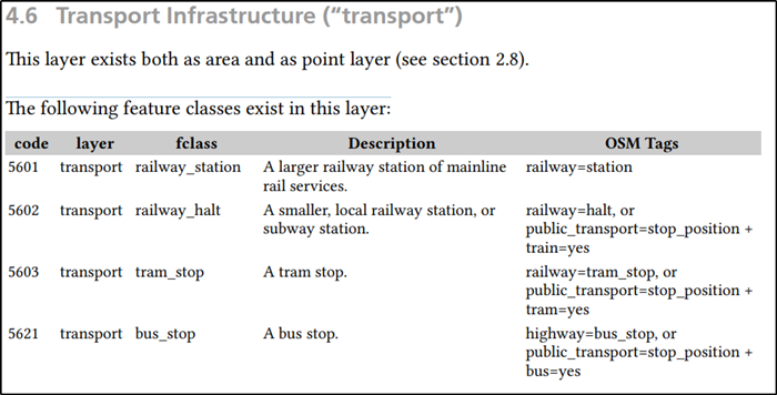
Currently I am using data for some regions (provinces) of the Netherlands via this link: https://download.geofabrik.de/europe/netherlands.html
However, when I download the shape files (.shp.zip) I cannot find the metadata that explains the variables to me. See the picture attached as example. What does 'transport' mean? or 'traffic'? Can someone tell me where to find this?


