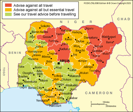
I am trying to stitch together FCDO country maps (JPEG) into a single world map while retaining the exact coloring of the zones. The maps are always tricolor (red, yellow, green) such as this map of Nigeria:
My idea is to georeference each map and export the coordinates with a column for the color parameter and then sequentially plot all coordinates with color on a separate canvas.
Is there a way to georeference the maps without manually setting points? (My current idea is to locate all cities using a B/W binary mask and match their black dot coordinates to real-world city coordinates from a cities database)

