1

Our company does a lot of bird surveys, we often need to draw flight patterns on a paper maps and convert these lines into shapefiles to create digital maps (e.g. of migration routes) for our reports. At the moment we do all the field work by hand and have someone digitize this information into QGIS.

Until now we have experimented with the Mergin Maps application for QGIS, with which we can create lines in the app using interconnected points, however it is not efficient enough for our work. Often we have to record 100s of individuals within 1-2 minutes and don't have time to set a large number of vertices for each line. What we need is to be able to draw lines on a tablet (ideally with ID numbers) and be able to georeference those lines automatically (without having to re-create each segment in QGIS). Does anyone have a reccomendation?

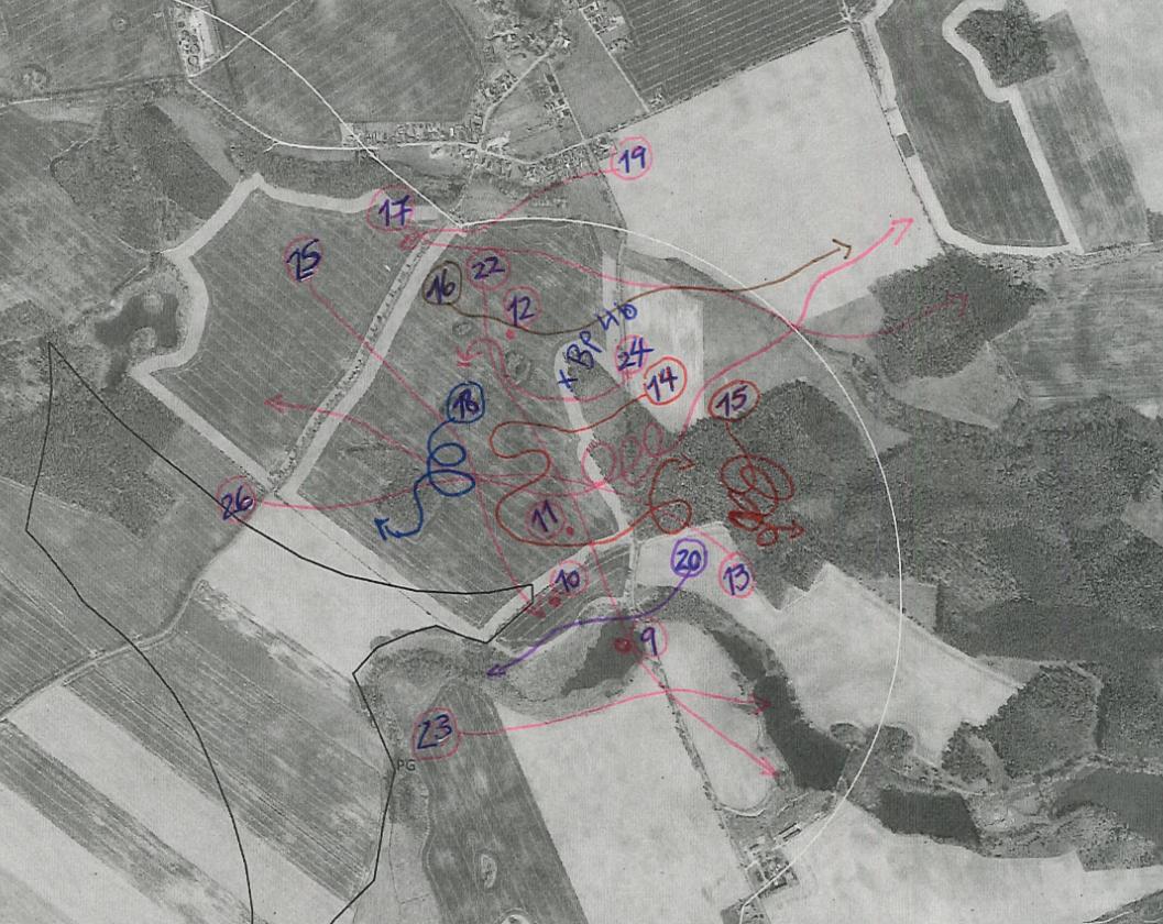
Below is an example of the handdrawn lines enter image description here

2
  • The new plugin (AI Vectorizer for QGIS) might be a good start github.com/BuntingLabs/buntinglabs-qgis-plugin
    – Mapperz
    Commented Feb 2 at 14:23
  • Not sure how feasible it is to adapt to your workflow be Field Papers (wiki.openstreetmap.org/wiki/Field_Papers, successor of Walking papers) create a base map with a QR code that allow to take a picture of the annotated map and have it automatically georeferenced. Its intended for updating OpenStreet map data but you could probably take some inspiration from this...
    – J.R
    Commented Feb 2 at 16:56

1 Answer 1

1

Ditch the paper. Set up a GNSS enabled QField project on your tablet. Gather and attribute data in real time.

And for past data, identify points in your paper maps that you can assign real world coordinates to. Fine the X, Y pixel locations for those locations in your (scanned) paper maps. Use GDAL and/or Python to automate the georeferencing process.

1

Your Answer

By clicking “Post Your Answer”, you agree to our terms of service and acknowledge you have read our privacy policy.

Not the answer you're looking for? Browse other questions tagged or ask your own question.