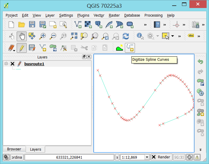
I'm a recent convert to QGIS but have been confused about the lack of support for drawing curved shapefiles, especially when Arc has almost too many. A lot of the work that our consultancy do is based around natural features such as lakes/rivers so there aren't many straight lines and being able to accurately represent or work with these features requires smooth curves as opposed to the tools I've been able to find on QGIS so far.
Other threads I've found relating to this have stated that being able to draw curves would require a fundamental redesign of QGIS, how is this though?
Other threads also recommend to use a rough shapefile first then simplify/smooth over to produce your curve but i would be worried about using this simply because you can't see the finished lay of the line when you draw it, which could be frustrating if your boundary moves after smoothing.

