4

I have a world map made up of 6 shp files. All the files and the data frame are set to WGS84. The way Arc 10 and 10.1 decides to display the files, it splits Russia into 2. The majority of Russia can be seen to the East, however, one small bit is displayed at the western extent of the map. This is a single polygon.

Is there a way to change the way ArcGIS treats this data so the the whole of Russia is displayed to the east? (I will eventually need to print the data).
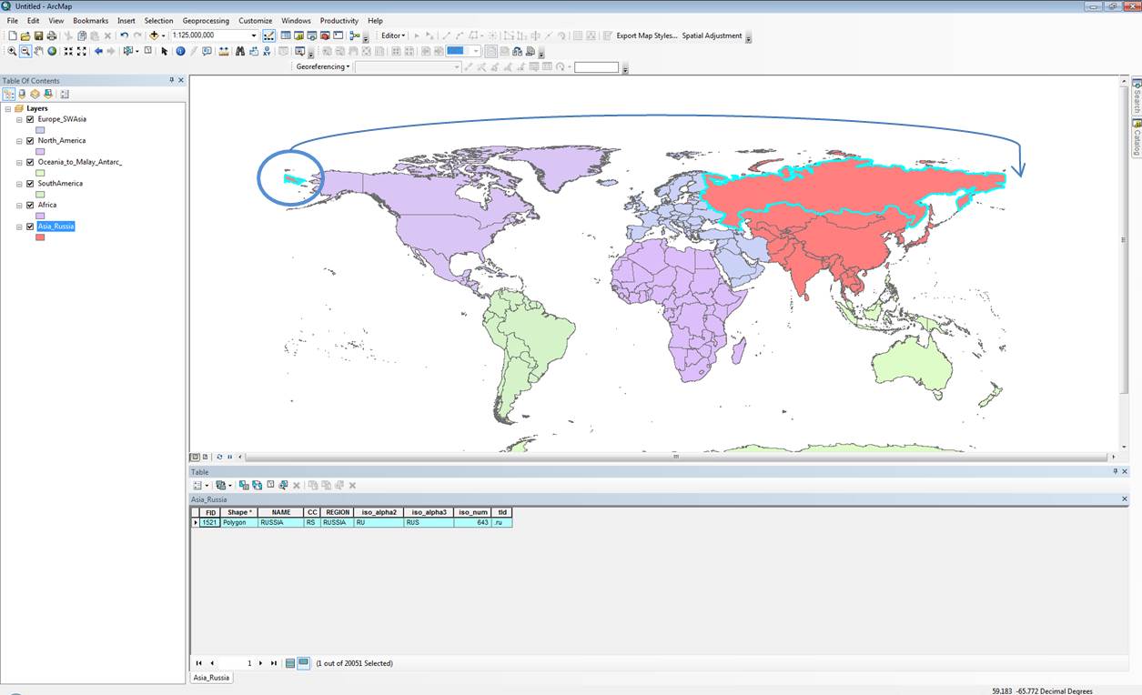
enter image description here

EDIT: I'm starting to think that in order to do this I might need to create a new coordinate system (a copy of wgs84) and offset the centre of it so that it sits to the east. Thoughts?

1

1 Answer 1

1

It's a single polygon, but it's a single multi-part polygon. The same is true for Alaska (which dangles off the far-east). Making a new GCS isn't going to help, but copying the part which dangles over the antemeridian and dissolving it with the rest of eastern Russia will allow you to make maps. Or you could use a client API which supports "wrap-around" (though I doubt this would help with such a large country). I've often copied all of the western hemisphere east of 180 longitude, and the eastern hemisphere west of -180, just to simplify basemapping.

2
  • You are right in that it is a multipart poly, I've tried your suggestion of dissolving. Dissolving as it is and also exploding to singlepart 1st. They both still give me the same result. Am I missing something??
    – Dan_h_b
    Commented Oct 18, 2013 at 13:26
  • 1
    Did you copy the western hemisphere part, then shift it 360 degrees east before dissolving?
    – Vince
    Commented Oct 18, 2013 at 13:29

Your Answer

By clicking “Post Your Answer”, you agree to our terms of service and acknowledge you have read our privacy policy.

Not the answer you're looking for? Browse other questions tagged or ask your own question.