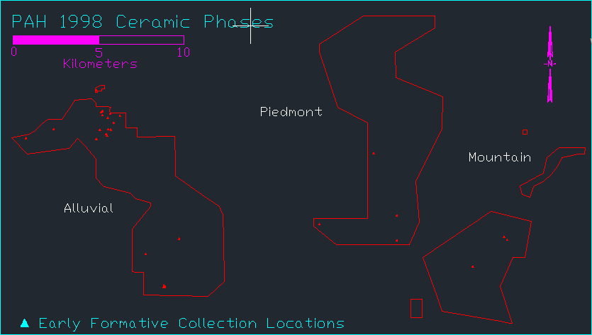
I am importing information from AutoCAD into Arcmap 10.1. I found after some issues that I need to give the incoming information geographic location, which works fine. The problem is that all the data appears the same. I have two maps with different points of collections, but when I bring over both maps, they give me the same data.
Pic1: is the data that I am pulling over from AutoCad
 Pic2: is what appears in Arcmap 10.1.

If you look at the bottom, you will notice that they are both suppose to be the same, but they are not. The title is different, and also when I bring it over to ArcMap 10.1, it has alot more points of data in the different areas.
I have bringing over alot of different maps, is it possible that my maps are reading data from a different map that I brought over before I was looking at these?
