I am using QGIS 2.16.
I have a database of 100 entries which has been categorised using a column of data that has 20 categories which essentially breaks up my map into 20 regions.
How do I create an automatic boundary around the 20 sub groups?
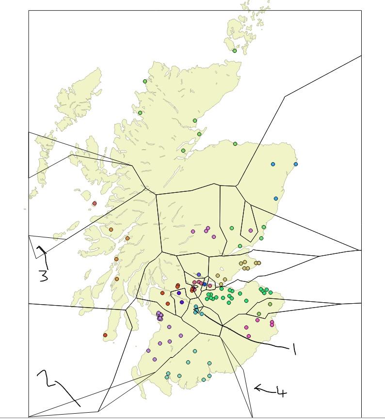
I went down the voronoi and dissolve route, which I think works but I have some queries to work out kinks. I'm unsure if this should be a new question entirely.
In points 2,3,4 there are unwanted polygons.
How do I remove these?
Whilst in point 1, the symbol within the triangle should black as it is a different category.
How do i fix this?
Is it my 20% buffer that is causing the issue?
Finally, how do I enlarge the 'frame' around the map of Scotland as it cuts through the Isle of Orkney (top of the map)?


