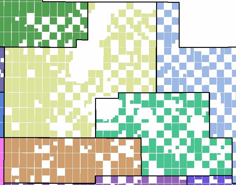
I am trying to find a tool or workflow for creating a type of minimum bounding polygon or envelope for complex land areas. (Not just a rectangle, but a simplified perimeter)
Can anyone recommend a way to create the simplified black boundary lines around the irregular colored checkerboard areas in the attached image without having to manually digitize.
I’m using ESRI ArcMap Advanced, but open to other tools.

