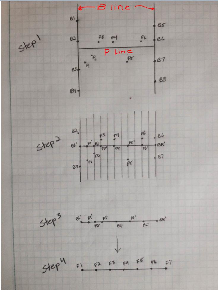
See sketch below.
The main objective, using ArcGIS 10 or 10.1, is to get the P points to the perpendicular P line and, either the closest B point to the endpoint of the P line where it interesects the B lines, or an averaged value, whichever is easier. My process for doing this is:
"Step 1" is the data as I initially have it. The parallel B lines have data points and the perpendicular P line has data points scattered around it.
To get to Step 2, I am creating perpendicular lines along the P line then joining the P data point attributes to the perpendicular lines. Then, I am creating points at the intersection of the P line and the perpendicular lines. I am then joining the perpendicular line attributes to the intersection points, resulting in the "Step 3" figure.
I am then creating points like those shown in Step 4 and doing a spatial join that assigns the closest value from the points in Step 3 to the F data points in step 4.
Is there a more efficient way of accomplishing this process?
I have about 400 P lines and anywhere between 200-1000 P points at each P line. I have tried using the Geospatial Modeling Environment, previously Hawth's Tools, with the snap points to line tool but am unable to get it to work "Command text could not be interpreted error). I think this is because I have P lines that are close together (the sketch below is a simplified idea of what I am doing) and when the tool is trying to snap points to line, the point lies within the snapping tolerance distance of 2 P lines, causing it to crash.

