2

I am quite new to QGIS and I am trying to do something which seems so simple but it won't work. I have looked for an answer and couldn't find any.

So I dowloaded data imagery from EarthExplorer about NDVI (Normalized difference vegetation index) and I am simply trying to load this image to my project in QGIS but it won't work.

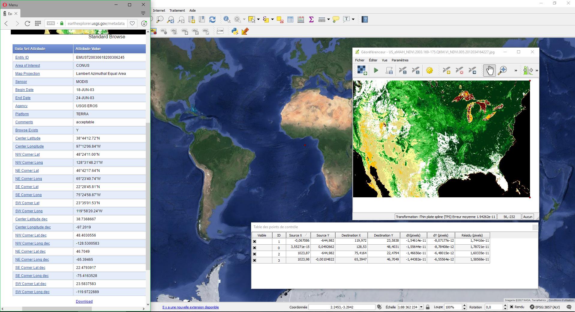
As you can see in the picture, the CRS for this image seems to be Lambert Azimuthal Equal Area, which in QGIS I assume corresponds to North Pole Lambert Azimuthal Equal Area considering it's North America.

So I used the plugin Georeferencer and did exactly as shown on the web : Upload my image, define its CRS (EPSG 102017 : North Pole Lambert Azimuthal Equal Area), set 4 points in the 4 corners for which I know the coordinates (see image on the left, it comes with the file), set the transformation parameters (CRS = EPSG 3857 for my project) and clicked to start georeferencing.

The thing is whatever I do (I tried every combination of the to CRS to go from-to) I get a tiny map near the African west coast (see red dot on image). I also tried different CRS and still won't work.

I do not know how to solve this problem. I have tried with other images from EarthExplorer (Landsat8 images) and the same thing happens.

Can anyone help me?

enter image description here

1
  • can you add screenshot of your project properties ( Project --> Project properties) ? Commented Feb 8, 2017 at 4:09

1 Answer 1

2

You are trying to georeference the thumbnail image? because the actual NDVI data is the TIF file, not the JPG.

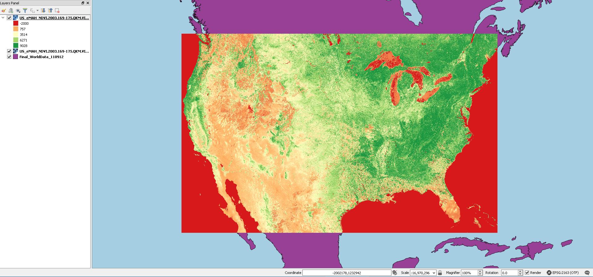
That TIF file has projection attributes and displays correctly. (BTW, it's EPSG 2163 US National Atlas Equal Area, your assumption was wrong)

enter image description here

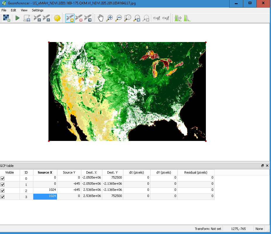
If you still want to georeference the JPG thumbnail, you can use the actual NDVI layer to extract extent values for the projected CRS and not WGS degrees like listed in EarthExplorer:

  • Xmin -2050500.0000000000000000
  • Xmax 2536500.0000000000000000
  • Ymin -2136500.0000000000000000
  • Ymax 752500.0000000000000000

We know the thumbnail dimension: 645*1024, and we know the origin is Top Left

enter image description here

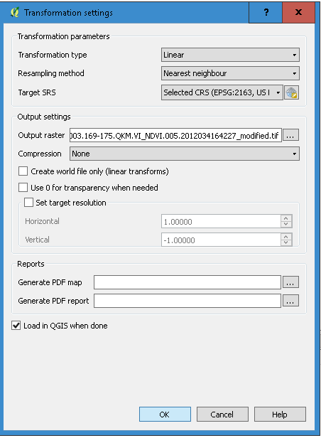
So setting a linear transformation (note my project is EPSG 2163) gives you the desired correct georeferencing.

enter image description here

And I'm reminding you again, that image is not NDVI values, those are RGB values of a simple JPG image.

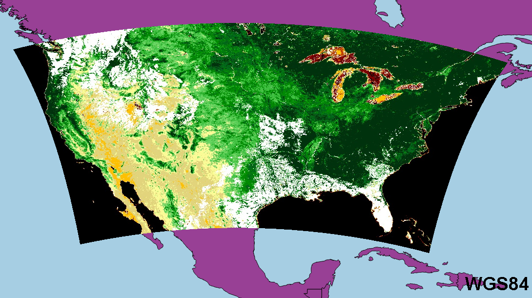
Georeferneced RGB image in WGS84 project CRS:

enter image description here

2
  • Thanks for the answer! I did it with the TIF file but it still won't work. It does the same thing. I used my project's CRS for the transformation and tryed with the same CRS as the TIF file and it does the same thing : Tiny red dot near Africa Commented Feb 9, 2017 at 16:45
  • Forget my last comment. It worked perfectly! Thanks a lot for the help! :) Commented Feb 9, 2017 at 17:14

Your Answer

By clicking “Post Your Answer”, you agree to our terms of service and acknowledge you have read our privacy policy.

Not the answer you're looking for? Browse other questions tagged or ask your own question.