2

I'm having trouble with two maps, both UTM33N/WGS84. They should be exactly on top of each other but there is a slight shift between them of probably a few hundred meters or so. enter image description here
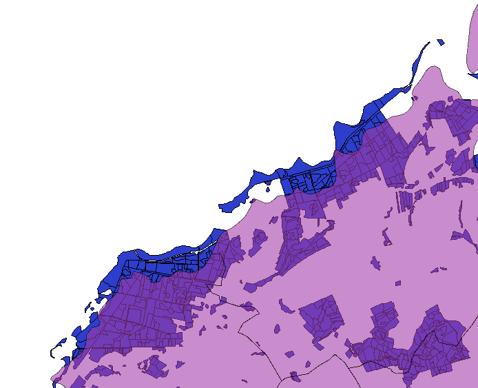
I Tried to adjust this with the Vector Affine Transformation Plugin but didn't succeed. I don't know how to use it.

2
  • 1
    Have a look at the answer here - qgsAffine is not easy to use, but works once you know the numbers to plug in. I do agree with @Darren Cope's suggestion though - check the origins and intended scale of each layer to see if they even should line up.
    – Simbamangu
    Commented May 10, 2012 at 16:50
  • 6
    Are you sure both datasets are on wgs84? A few hundred meters could be due to different datums.
    – mkennedy
    Commented May 10, 2012 at 18:08

3 Answers 3

4

I think we are getting somewhere. The original shapefile (contained in forste-orig.zip) appears to be Pulkovo 1942(83)/Gauss-Kruger Zone 4, which is EPSG:2398. So if you load this into QGIS and set its CRS to EPSG:2398, then save it as EPSG:32633 this should do the trick. Nick.

0
2

To me this looks like a 'scale' issue. The layers appear to be drawn at a different level of detail, and thus will never line up exactly. Am I missing something?

9
  • The curves look to have the same level of detail to me.
    – nmpeterson
    Commented May 10, 2012 at 17:40
  • @nmpeterson; I really don't think so. Look in the bottom-left corner specifically. There's no way this is can be a 'matching' dataset. Please don't downvote without closer inspection! Commented May 10, 2012 at 18:33
  • I inspected rather closely. The blobby features' coastal path seem to be a convex hull of the underlying polygons, but shifted dramatically (as the OP believes).
    – nmpeterson
    Commented May 10, 2012 at 18:44
  • It doesn't help that the underlying features seem to be only a sample of a larger dataset, making it more difficult for us to know where the actual "coastline" is in certain places, like the lower left -- are those actually islands, or just polygons whose neighbors aren't a part of the sample?
    – nmpeterson
    Commented May 10, 2012 at 18:46
  • Which is the dataset with the problems? If it's not confidential could you post a download link? Nick.
    – nhopton
    Commented May 10, 2012 at 19:31
2

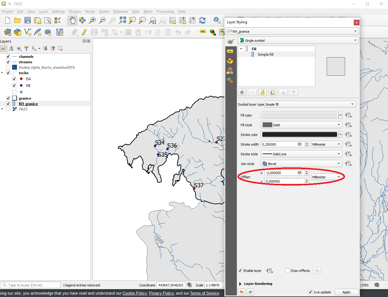
Found it! Just go to Layer Styling and adjust the offset, x or y.

enter image description here

Your Answer

By clicking “Post Your Answer”, you agree to our terms of service and acknowledge you have read our privacy policy.

Not the answer you're looking for? Browse other questions tagged or ask your own question.