1

I have sampling points in QGIS which all have a unique ID, and I'm trying to collect various geographic and climate data for those points from a variety of sources. Although the source raster data varies depending on what I'm measuring, I'm always using the Point Sampling Tool plugin to collect the data. The data are correct, but there is never an ID column in the output.

Does anyone know how to fix this?

1
  • 1
    Use join attributes by location to add the ID from the original layer to the new layer.
    – csk
    Commented Jan 2, 2020 at 17:59

1 Answer 1

1

I have a points vector layer, and two raster layers (one is an averaged resample of the other one).
The points layer has three attributes, fid is a unique identifier, class is a numeric classification and old_or_new is a text string classification.

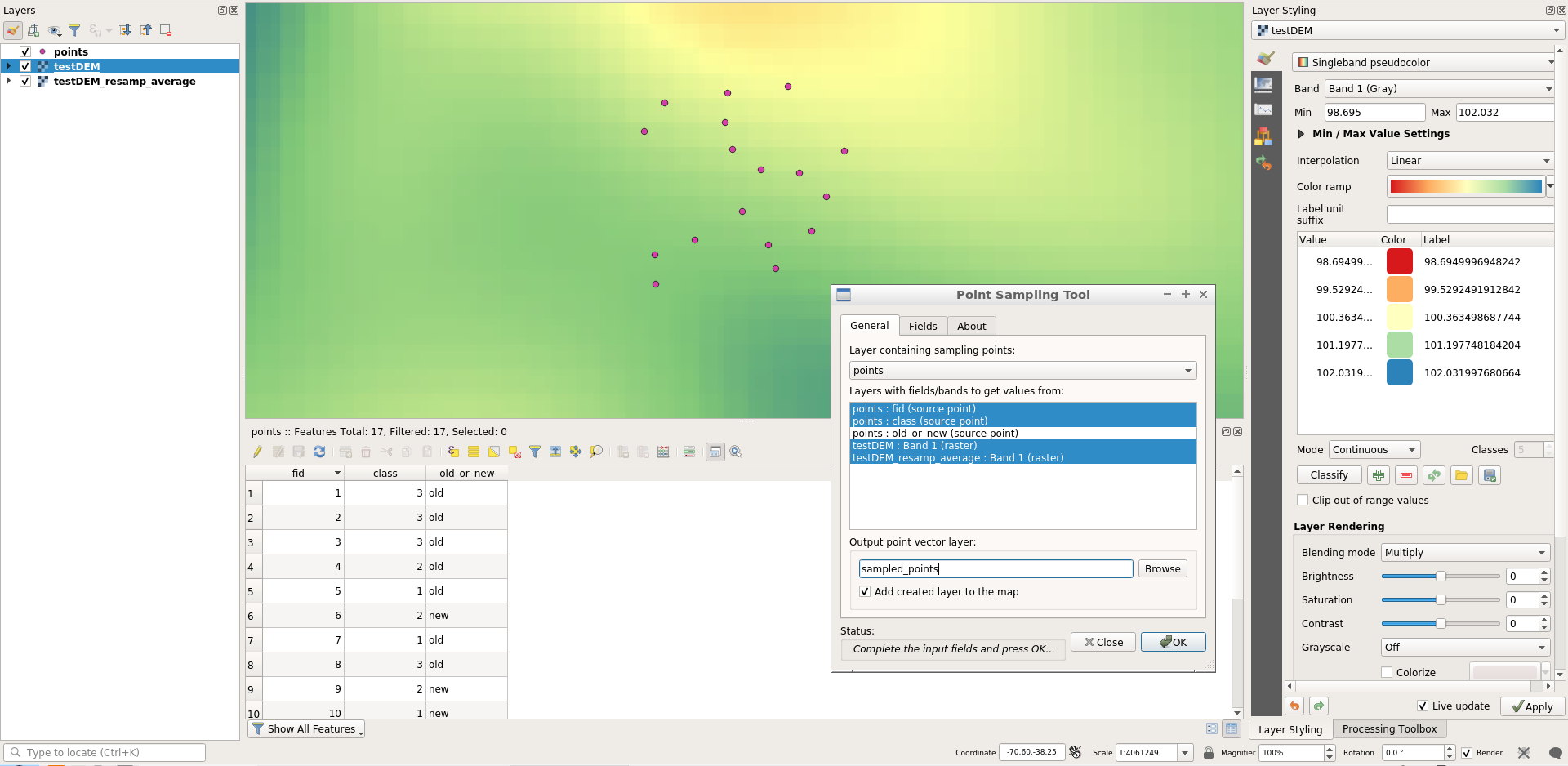
If I want the points with fid and class attributes, and both rasters band1 pixel values sampled, I need to select all that combinations of layer/attribute in the _General tab of the plugin:

1


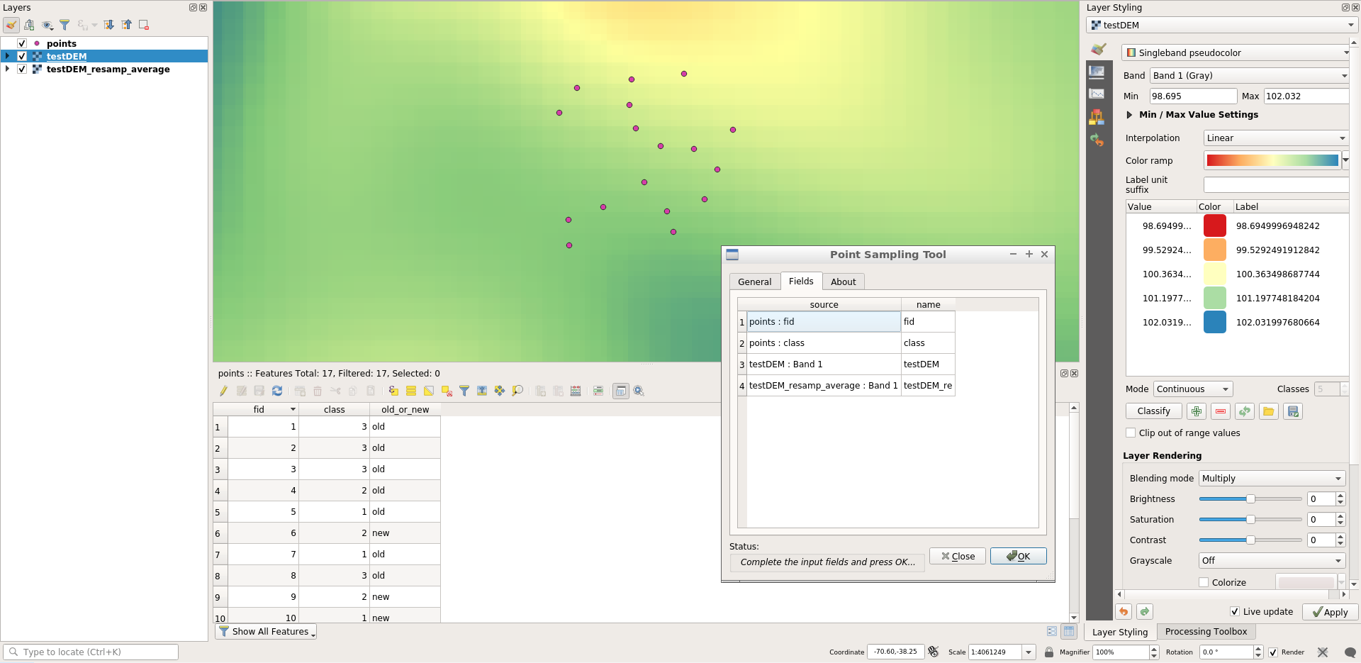
In the Fields tab, there are the fields will be extracted to the output points:

2


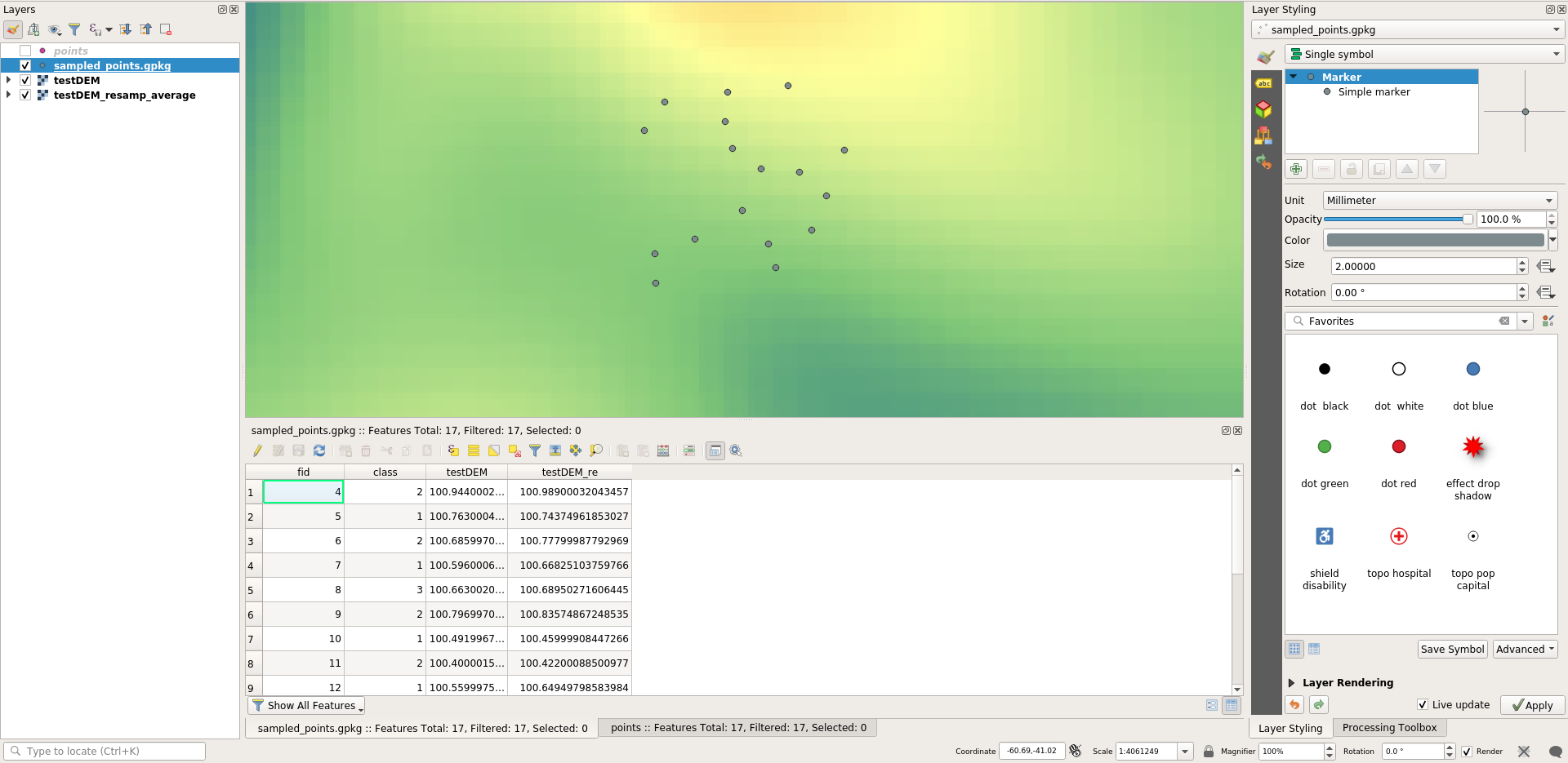
If you select the fields of the source points layer, then the sampled_points layer must have those attributes for each feature:

3

1
  • Thank you so much for the detailed explanation! Worked perfectly! Commented Jan 31, 2020 at 20:17

Your Answer

By clicking “Post Your Answer”, you agree to our terms of service and acknowledge you have read our privacy policy.

Not the answer you're looking for? Browse other questions tagged or ask your own question.