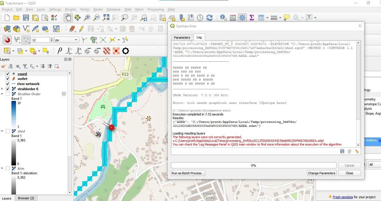
I tried delineating catchment area of a place. First I downloaded the DEM TIFF from internet. Then reprojected it to the required CRS. Then I used the Fill Sink tool and Strahler Order after that. Then I created a shapefile and located a single point in the river where I wanted to find the catchment. Then, I used Find XY tool to get coordinates and used the coordinates in the Upslope Area tool. I put the DEM without sinks layer in elevation, deterministic 8 in method and 1.1 in convergence. Then I run it but I always got the error.
2 Answers
A small addition needs to be made in the ta_hydrology_upslope_area.txt file included in the SAGA installation files.
In the txt file, the Upslope Area part should be edited as Upslope Area |4 and saved.
source: https://youtu.be/t-2ExoyhIfA
-
please, what is the solution for mac? it has dylib files only– travduCommented Jun 17, 2022 at 19:18
Check if the log message gives you more information, menu view > panel > log message. Other recommendations
- If the basin raster is not generated, check if the DEM coordinate system matches the point coordinate system (CRS). This tool does not have reprojection.
- It may be a processing error, create a new profile, in configuration > user profile > new profile.
- If this fails try running directly in SAGA,


