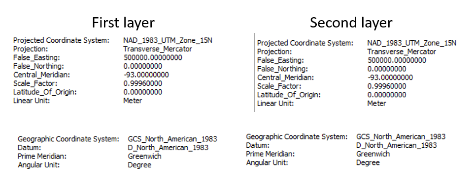
I have a mask that I created. I used calculate geometry in the attribute table to calculate the acres of the polygon (1,214,784 acres). I then used the intersect tool with the mask and another layer to cut the other layer to this exact size. When I calculate the area of this layer and look at the total acreage using statistics, it is 1,214,807 acres. (23 acres larger)
I tried it with the clip tool and got the same result. I thought maybe there was something overlapping so I used the dissolve tool on it and it was still 1,214,807 acres. How could it be larger? I thought maybe it was the coordinate system, but they both appear to be the same.
I've tried projecting both layers. I even tried calculating the geometry using both the coordinate system of the data source and the coordinate system of the data frame.
Why it is not calculating the geometry correctly? Or rather, what am I doing wrong?

