2

I am trying to georeference an old map of Italy (https://www.mapsland.com/maps/europe/italy/large-scale-old-political-and-administrative-map-of-italy-1890.jpg) using QGIS3.

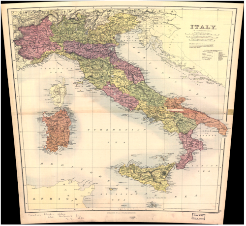
I've set a reasonable number of GCPs but no matter what CRS I seem to assign it seems to want to be projected to an equirectangular projection. I'd like to keep the output as close to the original projection (which has curved latitude lines) as possible to maintain the original 'rectangular' shape of the whole image (i.e. get rid of the black/nopixel warping at the edges).

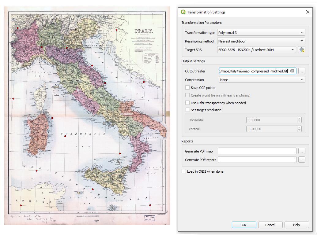
An example with a Lambert target SRS is shown below:

Lambert input

Lambert output

Perhaps there is something I'm not quite getting about setting the correct CRS.

I found these similar questions but not a solution that worked for me:

1
  • Why don't you try referencing the image to EPSG:4326? Or even better, some older version of WGS84.
    – Erik
    Commented Sep 21, 2021 at 12:26

1 Answer 1

1

There are two things you can do to resolve your problem:

  1. Set your project CRS to the same (or a similar) CRS that your historical map was produced in. Like this, you can avoid massive warping of the image. See also here: https://gis.stackexchange.com/a/392557/88814

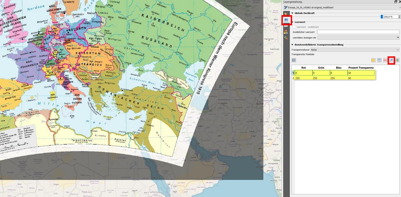
  2. You can get rid of the black pixels by setting them to transparent. In the raster layer's Layer styling panel go to Transparency and select Add values from display, then click on a black spot and all black pixels will disappear:

Black and white pixels (=RGB 0/0/0 and 255/255/255) are set to 50% transparency each, using the red highlighted symbol and clicking with it on the corresponding color on the map. If Transparency is set to 100, these pixels diappear completely: Fallentwicklung_2021_08_23_UZH_Oeffnung.png

Your Answer

By clicking “Post Your Answer”, you agree to our terms of service and acknowledge you have read our privacy policy.

Not the answer you're looking for? Browse other questions tagged or ask your own question.