1

I am trying to reproject a global raster (this: https://sedac.ciesin.columbia.edu/data/set/wildareas-v3-2009-human-footprint/data-download, I named it HFI) from Mollweide (its projection) to LAEA3035 and clip it to Europe. Usually, these are the steps I follow:

  • I create a location with the same coordinate system of the file (in this case, I selected "choose the coordinate system from a referenced file", and used this raster as reference),

  • switch to the Location LAEA3035, where I set the region and resolution: g.region -p res=1000 raster=myEuropeRaster

    projection: 99 (ETRS89_LAEA_Europe) zone: 0 datum: etrs89 ellipsoid: grs80 north: 6824829.90382694 south: 1385914.39679116 west: 944055.47446584 east: 7602904.43906583 nsres: 999.98446535 ewres: 999.97731861 rows: 5439 cols: 6659 cells: 36218301

  • create a mask r.mask raster=myEuropeRaster

  • run r.proj location=MOLL mapset=PERMANENT input=HFI output=HFI

It isn't working. First it throws two warnings:

WARNING: proj_trans() failed: acos/asin: |arg| >1.+1e-14

WARNING: proj_create() failed for '(null)'

and then an error:

ERROR: Unable to initialize coordinate transformation

This is the selected PROJ pipeline that appears:

Selected PROJ pipeline:
+proj=pipeline +step +inv +proj=laea +lat_0=52 +lon_0=10 +x_0=4321000
+y_0=3210000 +ellps=GRS80 +step +proj=moll +lon_0=0 +x_0=0 +y_0=0
+ellps=WGS84

I searched online but couldn't find much information on how to solve this issue... I am using GRASS 7.8.6 on a server running Ubuntu 18.04.6 fro a Windows 10 machine.

2
  • The LAEA3035 mapset should be in its own, separate location, based on EPSG 3035.
    – Micha
    Commented Jul 28, 2022 at 20:14
  • Yes, I have a different mapset in a different location based on EPSG 3035 (it is when I wrote "switch to the LAEA3035 mapset"). g.region -p output says projection: 99 (ETRS89_LAEA_Europe)
    – LT17
    Commented Jul 29, 2022 at 10:00

1 Answer 1

0

I think that the problem is the extent of the original human footprint raster. It must be beyond the extent that is within the bounds of ETRS (EPSG:3035)

Here's how I worked it out:

  • First I created a Mollweide location (as you already did), based on the downloaded human-footprint raster. And I imported that raster.

  • Then I made another location (again, you already did this), based on EPSG:3035.

  • Now I set the computational region to some "reasonable" bounds:

    micha@RMS$ g.region -ap
    projection: 99 (ETRS89-extended / LAEA Europe)
    zone: 0
    datum: etrs89
    ellipsoid: grs80
    north: 5600000
    south: 0
    west: 800000
    east: 8500000
    nsres: 1000
    ewres: 1000
    rows: 5600
    cols: 7700
    cells: 43120000

(Note that the resolution is set to match the original human footprint raster, 1000m.)

  • Now I was able to reproject the Mollweide raster, while limited to the computational region.

HTH

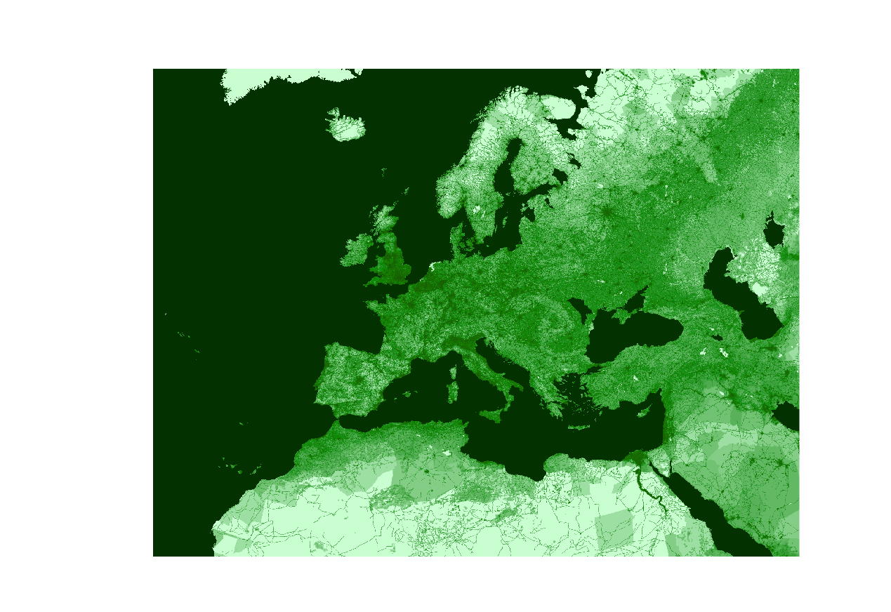
Projected result

6
  • Hi Micha, I tried to set your same computational region (g.region n=5600000 s=0 e=8500000 w=800000 res=1000 -ap, resolution is 1000) and reproject the raster from the Mollweide location (r.proj --o location=MOLL mapset=PERMANENT input=HFI output=HFI) but I get again the same problem. I also tried with different global raster (Mollweide projection) and the problem persist.
    – LT17
    Commented Jul 30, 2022 at 15:08
  • P.S.: in Mollweide location I also tried to clip HFI raster to myEuropeRaster, and reproject the clipped raster to EPSG:3035 location - it didn't work.
    – LT17
    Commented Jul 30, 2022 at 15:35
  • Sorry, out of ideas :-(.
    – Micha
    Commented Aug 2, 2022 at 9:36
  • Thanks for the help, Micha. I resolved using gdalwarp: I reprojected from Mollweide to WGS84, and then cropped to Europe while reprojecting into LAEA3035. But still couldn't understand the problem outlined in my question.
    – LT17
    Commented Aug 6, 2022 at 13:57
  • 1
    If you want to carry on with the issue, try reporting on the grass-users maillist. Include your commands and the error you got.
    – Micha
    Commented Aug 7, 2022 at 16:11

Your Answer

By clicking “Post Your Answer”, you agree to our terms of service and acknowledge you have read our privacy policy.

Not the answer you're looking for? Browse other questions tagged or ask your own question.