3

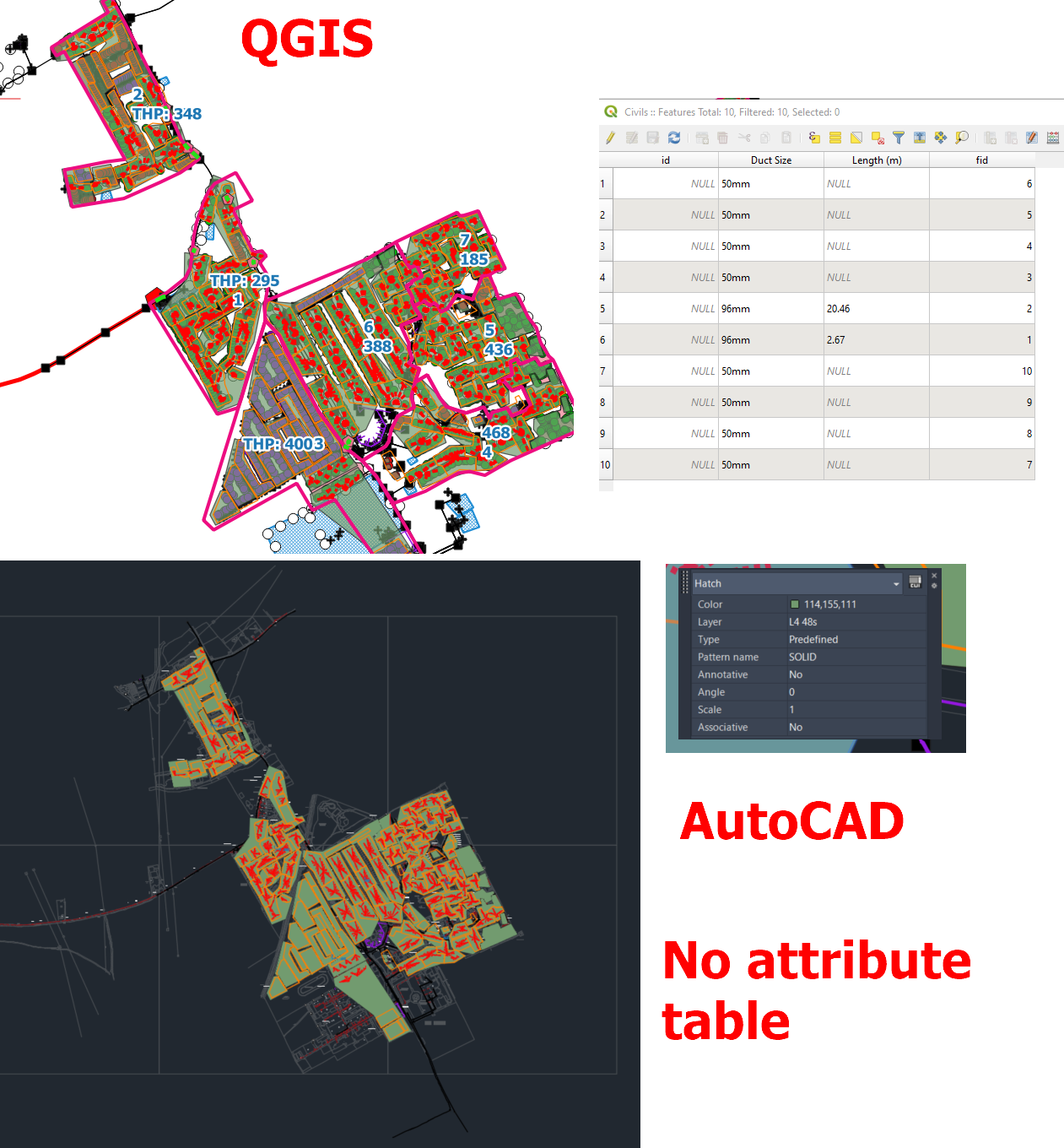
I have managed to export my QGIS project (with more than 10 layers) to AutoCAD DXF format.

enter image description here

The problem is, that I cannot find the attribute table data in AutoCAD.

Amidst a few options, which are here:

https://forums.autodesk.com/t5/civil-3d-forum/how-to-transfer-shapefile-attributes-from-gis-into-autocad/td-p/8442245

https://github.com/qgis/QGIS/issues/34156

They advise typing the command: MAPCONNECT, MAPWSPACE, or MAPIMPORT.

Unfortunately, none of them work in the AutoCAD Lite version.

How can I transfer the attribute table along with my QGIS project without splitting it into separate layers?

UPDATE:

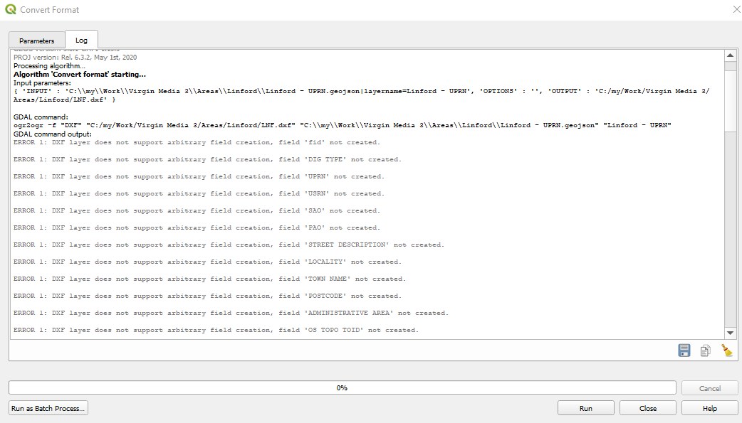
I tried also via GDAL, but I have the following error:

DXF layer does not support arbitrary field creation, (field name) not created

enter image description here

1
  • Why is splitting into several layers unwanted, if it works? Have you had a look at the spatial manager for CAD?
    – Erik
    Commented Aug 30, 2022 at 11:32

1 Answer 1

6

Alfred NESWADBA answer from your first link state :

Polylines in AutoCAD does not have more informations than AutoCAD has for them, like layer, linetype, ... And as long as you only have polylines from AutoCAD they can't have any more informations, that is one difference between CAD and GIS.

In Map3D you might use ObjectData, with that option you can create ObjectDataTables in your DWG-file and then assign ObjectDataRecords to each polyline. But that is by far not so easy to edit and handle as the SHP dataset is.

So if you only have AutoCAD Lite you can't get attribute, you need Map3D or Civil3D to access or import shapefile.

(ESRI give these instruction to export attribute values to AutoCAD block attributes, I don't know if this would work with QGIS export to CAD but you may try it...)

Your Answer

By clicking “Post Your Answer”, you agree to our terms of service and acknowledge you have read our privacy policy.

Not the answer you're looking for? Browse other questions tagged or ask your own question.