When I try to add a jpeg file into my project on Arc it displays only in black and white.
I have checked the file and it is definitely in colour.
Does anybody know how I can add such files in the project in colour?
When I try to add a jpeg file into my project on Arc it displays only in black and white.
I have checked the file and it is definitely in colour.
Does anybody know how I can add such files in the project in colour?
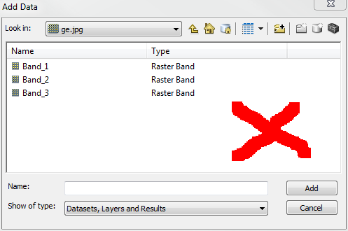
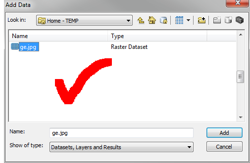
Based on your comment, it sounds like you are adding each raster band separately, instead of the raster dataset. When you use the Add Data button and navigate to your jpg, don't double click on the jpg filename and select the individual bands, just select the file itself and click the Add button.


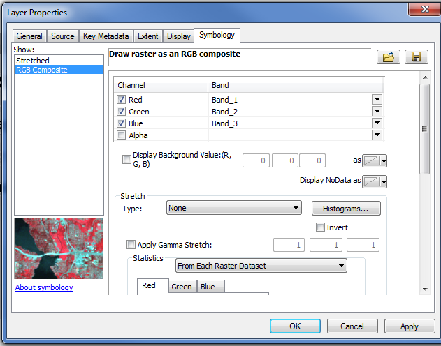
It sounds like the symbology settings are using a stretched value rather than RGB.
Open the properties of the JPG and go to the Symbology Tab.
Make sure RGB Composite is selected.
