1

This should be simple: have a shapefile in UTM z16 DatumNad27 and want to transform it to Datum WGS84 latlon I am using Qgis 2.6

Sorry I am going to clarify, with the steps taken:

1- XY data of a landfarm, I converted to shape and load it in Qgis. (NAD27_UTM 16N)

2- I have recorded gpx data, a pathway to a volcano (amazing by the way). Load gpx data in Qgis.(WGS84)

3- When loading google satellite or OSM Landscape (WGS 84/Pseudo Mercator), gpx data aligns very well. But line derived from XY is not aligned.

4- Of course I am using "transformation on the fly". But it does not aligned.

5- When projecting XY line, using SAGA algorithm,and specifying WGS84 as targetCRS, it produces no changes (see image)
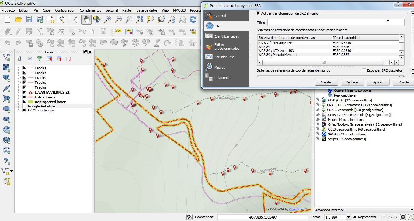
Projetion failed

9
  • So do it. What is the problem you have or the problem you'd like to ask? On the fly reprojection might be enough.
    – BradHards
    Commented Nov 22, 2014 at 1:23
  • 1
    You have to choose the layer, right click and choose save as. You have to define the new crs in your case 32616. Keep in mind that depending on the region of your map you have to know also the parameters for datum shift. Check this: earth-info.nga.mil/GandG/publications/tr8350.2/wgs84fin.pdf and look in appendix b the parameters for the region you want to make the reprojection Commented Nov 22, 2014 at 1:32
  • Does it fit better when you add the XY layer as WGS84 UTM16N, NAD27(76) UTM 16N or Mexican Datum of1993 UTM 16N?
    – AndreJ
    Commented Nov 22, 2014 at 19:32
  • 1
    I know you are usin Qgis, but I checked the transformation information in ArcMap. According to this es.scribd.com/doc/2618870/ArcGIS-Transformations for ArcMap you have to use NAD27 to WGS84 transformation 2. In this document: resources.arcgis.com/en/help/main/10.1/003r/pdf/… at page 53 the parameters for ArcMap´s NAD27 to WGS84 transformation 2 are the ones I mentioned before Commented Nov 22, 2014 at 21:46
  • 1
    I compared XY coordinates with known point, and it turns out that original XY data is in WGS_1984_UTM_Zone_16N, so now is aligned and transformation worked just fine! Commented Nov 22, 2014 at 22:15

1 Answer 1

3

In this case, you need to know exact CRS your XY data represents. For that use reference data such as imaginery, aereal photography and compare XY data with known locations. For this you can use pluggin coordinates capture is useful.

Please refer when using Datum transformations to parameters values, as @Gerardo Jimenez pointed out: http://earth-info.nga.mil/GandG/publications/tr8350.2/wgs84fin.pdf

Finally Projections on the fly works very well whenever you have the right CRS specified in your data.

Your Answer

By clicking “Post Your Answer”, you agree to our terms of service and acknowledge you have read our privacy policy.

Not the answer you're looking for? Browse other questions tagged or ask your own question.