11

I already have basemap data. For that Bing Maps or OpenStreetMap are fine.

However, for demonstration purposes I need data for operational layers that I can throw on top of this.

It needs to be free, within Australia, and open for use.

For example:

  • Flood Zone Data
  • Historic bush fire data
  • Historic weather data
  • Census data
  • Crime data
  • Disease data

Are there other sources of Australian spatial data?

0

8 Answers 8

9

Try data.gov.au for Australian spatial data. Most of it in kml/kmz format.

Most state governments also have equivalent sites. For example:

Geoscience Australia has an extensive catalogue of data for sale or for free download, including the Geodata 250K Topography dataset package. Also, the Bureau of Statistics now offers a lot of data (including historical) in spatial formats.

A few of these sites will require a sign-up, but beyond a basic form to fill in you should be good to go with the data.

8

This question has been converted to Community Wiki and wiki locked because it is an example of a question that seeks a list of answers and appears to be popular enough to protect it from closure. It should be treated as a special case and should not be viewed as the type of question that is encouraged on this, or any Stack Exchange site, but if you wish to contribute more content to it then feel free to do so by editing this answer.


Australian 2006 census

  • Download the digital boundaries from the ABS here.
  • Download the census tables (at Collection District level) here.

Australian 2011 census

  • digital boundaries and census tables available here (you need to register)

Postal areas and Suburbs

  • Download boundaries from the ABS here. (Postal areas are similar to but not quite identical to post codes. The latter are only available commercially.)

Crime

  • Crime statistics (New South Wales only) available here - links to the ABS digital boundaries
8

My list of Free GIS Data lists freely available GIS data for various countries including Australia. Unfortunately there is only one link for Australia, but that is to a government site which seems to provide a lot of data.

Also, a large number of global datasets are linked to on that page, which may give you interesting data to demo to your clients (for example, climate data, gridded population data, airline route data).

3

Universities are also a good starting point for acquiring free GIS data. Depending upon the scale of data you want government agencies usually offer data for free too, however the detail of data may increase at a more local scale such as at the county or city level (e.g. aerial imagery). Here are a couple of links to get you started.

University of Melbourne GIS

Bushfire protection areas

3

You can get some pretty good info from here Queensland Government Information Service . Property boundaries, mine areas, pest areas etc

Just check the licence when you download them.

3

I know this is an old post, however I have processed the Census data along with Australia Post and the Gazeteer and have created individual KML files for each suburb boundary and put it on GitHub.

You can get it here: https://github.com/aidanmorgan/aus_suburb_kml

2

For fire data, visit:

http://earthdata.nasa.gov/data/nrt-data/firms/active-fire-data

You can download archived fire data from FIRMS as well.

1

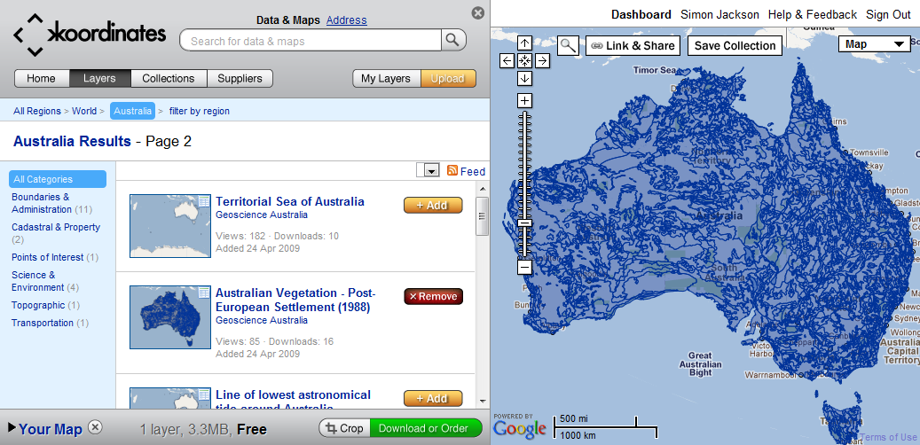
Found an excellent source for data called Koordinates.

enter image description here

Thanks for all the links so far.

Not the answer you're looking for? Browse other questions tagged or ask your own question.