My organization is working on an application running on ArcGIS Engine. Previous versions of the application used primarily Shapefiles for displaying roads, parcels, buildings, etc.
Since I was taught to avoid Shapefiles when managing data at my college job, I suggested moving to file geodatabases.
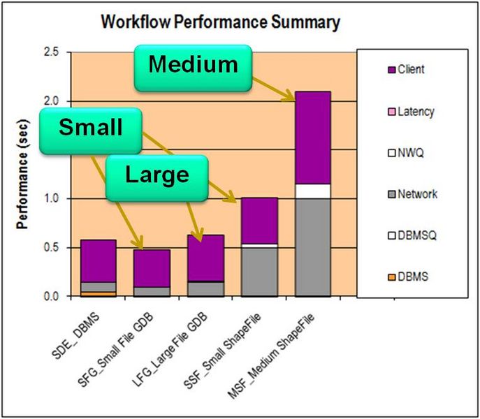
Esri claims file geodatabases are optimized for performance and storage.
My co-worker remembers hearing that Shapefiles usually draw faster.
I didn't come across an article directly talking about this topic, so I thought I would ask the community.
I'm leaning towards file geodatabases, but it would be nice to know if I'm missing out on anything that Shapefiles offer.

