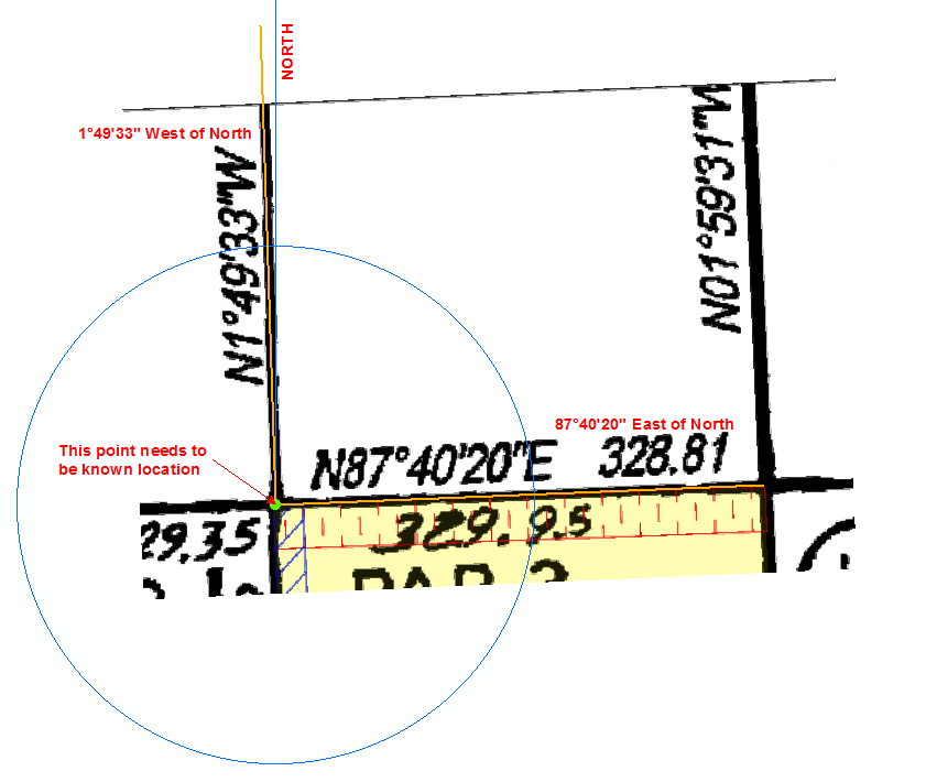
I don't believe you can calculate a position from these values. These look to be bearings and distances - a direction around a circle from a known location.
The known location could be anywhere in the world, and the boundary lines are drawn in the direction and distance listed from that known location. These are used to create lot boundaries.
Basically it's something like this (probably over-simplified). The N represents the compass bearing the values are based on. I believe these are usually either North or South (but have seen some with East and West). In this case, as it's N for North, the angles are to the E East or W West of that North bearing. The 328.81 is the distance from your known location, in the direction of your bearing.
The point of intersection needs to be known. Usually a lot plan will have an origin point to base the rest of the lines from, and then subsequent lines are started from the end of the previous line. If you don't know where that origin point is, then you may be out of luck.

It's been a very long time since I've input boundaries from plans like this, and I only ever did it while learning, so I may be wrong with some of it, but I think I got the basics right here.


