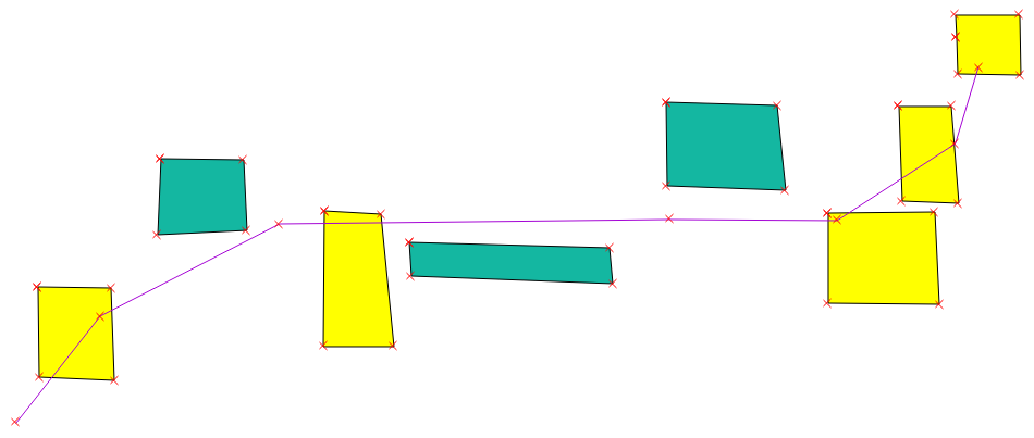
You want the Select By Location tool. It's under the menu Vector -> Investigation Tools (or something). Choose the layer you want to select from (in your case, the polygons), and the layer you want to act as a location restrictor (the lines). Then, you choose a spatial relation. You may see "Crosses" in the list, but that means a line must enter and exit a polygon, otherwise the polygon won't be counted. If that's what you want, then that's the relation for you, if otherwise you just want any polygon your lines touch upon, then go with Intersects.

Then you can export only the selected polygons in a new layer. A few things to note, however:
- Your lines layer and your grids layer must be in the same Coordinate Reference System, otherwise the selection will return incorrectly.
- This tool measures all lines against all grids. If you just want to know all grids that are crossed by any one (or more) lines, then it's fine. If, however, you want to know which grids are crossed by which lines, then you'll need to first select each individual road, and do this procedure. If you have selected feature(s) in your restrictor layer, the tool will only use those to evaluate which polygons are crossed by.

