0

I am using QGIS 2.16.

I have a database of 100 entries which has been categorised using a column of data that has 20 categories which essentially breaks up my map into 20 regions.

How do I create an automatic boundary around the 20 sub groups?


I went down the voronoi and dissolve route, which I think works but I have some queries to work out kinks. I'm unsure if this should be a new question entirely.

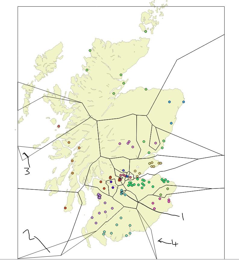
In points 2,3,4 there are unwanted polygons.

How do I remove these?

Whilst in point 1, the symbol within the triangle should black as it is a different category.

How do i fix this?

Is it my 20% buffer that is causing the issue?

Finally, how do I enlarge the 'frame' around the map of Scotland as it cuts through the Isle of Orkney (top of the map)?

enter image description here

3
  • 1
    Wecome to GIS SE. Please take the time to take the Tour, which explains our "Focused question / Best answer" model. Unfortunately, this is a request to start a discussion about symbology, which is both broad and opinion-based. While it wouldn't be off-topic in Geographic Information Systems Chat, you might have larger participation in a forum dedicated to discussion.
    – Vince
    Commented Mar 17, 2018 at 13:32
  • 1
    It is indeed very different from the original question. Regions = polygons. You are not looking for styling a border but for creating polygons from clusters of points
    – JGH
    Commented Mar 18, 2018 at 20:01
  • Fair enough - I'm lacking in the terminology unfortunately!
    – McGraw
    Commented Mar 19, 2018 at 9:16

1 Answer 1

5

You can create a border around the classes via a virtual layer.

The virtual layer would create the polygon union by class, and you then style it to show just the border. Note that it works best on smaller datasets.

So, go to the menu layer / add layer / add/edit virtual layer and enter the query

select st_union(geometry) from myLayer group by myClass

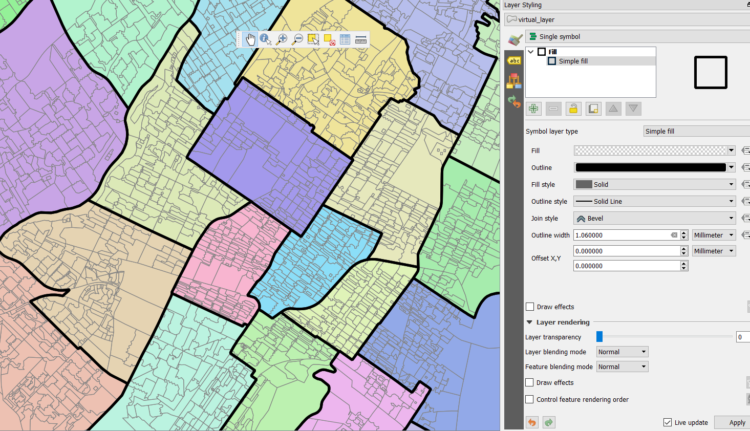
Then style this layer with a single symbol and a transparent fill.

In the following image, I have colored small polygons by their class and drawn the exterior class ring via the virtual layer

enter image description here

1
  • I'm guessing here but I'm assuming mylayer and myclass should be changed with the terminology relevant to my project? Eitherway, I did this: select st_union(geometry) from 'reserves' group by 'LocalGroup' It presents the data as points but no boundaries as per your figure, JGH.
    – McGraw
    Commented Mar 18, 2018 at 9:40

Not the answer you're looking for? Browse other questions tagged or ask your own question.