In short : I'm looking for a Visibility Manager (QGIS 2.18) ou Theme Manager (3.0).
I couldn't find it in the QGIS plugin list or in different methods on gis.stack. Maybe I missed it and maybe it hasn't been invented yet. I'm not looking for a dev to do it for me (altought you're welcome if you like the challenge ;) ), i'm just seeking information on the subject for the moment.
Explanation
I use a lot visibility settings. Some examples =
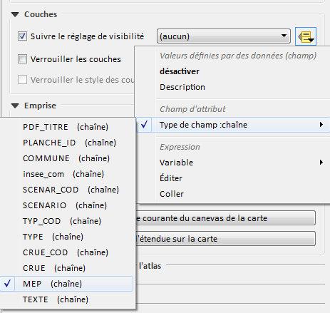
- historical data atlas where geometry doesn't change but where i loop across multiple raster and shapefiles on the same area with a field in the coverage table where I put my visibility setting name (Historical_1950, Historical_1960, etc.)
- polluted soils sample analysis point classification and combinaison (Parameter_1_From_0to1m, Parameter_1_From1to2m, etc.)
- flooding atlas with multiples scenarios, areas, and flood levels.
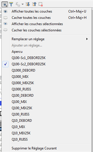
Below a full example for flood maps settings (sorry it's in french but the example should be understandable), in the map window, in the composer windows and the source in Excel, where I keep all the settings:
Now, I'd like to go further and be ableto create an automated list of settings from an Excel sheet with visibility/theme names depending on a set of vector and shapefiles with data defined filters.
what I'm looking for
My dream tool would be a dialog with the list of layers associated with a Theme/visibility setting. It would be possible to modify a setting easier, import or export a set of configuration, maybe change it in Excel for example, instead of click/replacing themes when something changes.
Example : I have 600 A0 sheets set up in ~52 visibility settings and my client wants to see a new layer on all maps. I'll have to activate the setting, click on the new layer to activate it, then go into the visiblity menu and replace the current setting... for all of them. It's a very annoying task, and I might do some mistakes.
Does this exists ? If not where should I seek to automate those settings edition ?


<visibility-preset name="Apercu"> <layer style="" id="Limite_de_commune_20180321204149833"/> </visibility-preset>