0

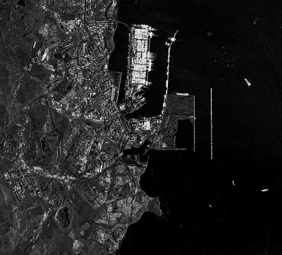
Here is an imagery from a radar satellite

enter image description here

Is it possible to colorize a radar image, so it looks like and enables the same kinds of analysis as for an image captured from an optical satellite (simple RGB imagery)?

Since radars can capture imagery even through clouds and with no visible light on the Earth, it seems I have access to a much larger archive of imagery if I can just give the "same properties" to radar imagery.

1 Answer 1

3

You can't give a Radar image the same properties as an optical image. The wavelength used for producing the different images doesn't give you the same information at all.

You "see" a similar image because the electrical signal received by the captor is converted to a digital numerical value and then to a grey value in a n bit depth so it can be displayed on a computer screen. But you actually see the same scene (compared to an optical image) with a completely different perspective. Those two electromagnetic waves operates in a range of wavelength that are physically very different and thus have a completely different behavior with it's environment.

But if you don't care about the information in the image and you just want to "colorize" the image only for a visual effect, maybe you could pansharpen it with an optical image. But then you could simply use the optical image directly if the spatial resolution is adequate for your needs.

6
  • Thanks for your answer! Sorry for not being very clear. I would only need the imagery to, for example, detect ships. With optical satellite imagery, I have a problem with cloudy images, so I guess I could just use radar imagery to which I have assigned colors, so it looks exactly the same as my optical imagery. Would it be possible to complement optical imagery with radar imagery to which I have assigned visible colors or are they completely different also in that sense?
    – GIS
    Commented Sep 11, 2018 at 11:51
  • But it won't look exactly the same as an optical image since the radiometry is different. First, you would need at least three bands in your radar image so you can assign each of them to a RGB channel. But this will not represent the actual RGB reflectance of your targets at all. If get to do something like that, the colors will be kind of funky on the resulting image. Commented Sep 11, 2018 at 12:00
  • 1
    And I know it was just an exemple, but if you want to detect ships in the sea, you are better with a radar image rather than an optical image. They will appear as bright white spots surrounded by dark pixels on the image. Canada uses radar a lot specially for that particular use case. Commented Sep 11, 2018 at 12:02
  • Okay, thanks! But if I have already trained an algorithm to predict ships very well on optical imagery, would it be possible to transfer the algorithm to work on RGB-colorized radar imagery or will the difference in projections screw up any prediction model?
    – GIS
    Commented Sep 11, 2018 at 12:06
  • Humm I am not a pro in digital image processing, but I guess it could give not really accurate results since the radiometry would not be the same as a true RGB image. Commented Sep 11, 2018 at 12:10

Your Answer

By clicking “Post Your Answer”, you agree to our terms of service and acknowledge you have read our privacy policy.

Not the answer you're looking for? Browse other questions tagged or ask your own question.