DB_REF is the official reference system for german federal railways - Deutsche Bahn (DB). For a description, see here: http://download-data.deutschebahn.com/static/datasets/aufzug/DB_REF.pdf (german)
The document mentions several EPSG codes, see below. However, trying to view any coordinates given in DB_REF (the actual EPSG code is missing very often), i come up with a position offset of 100m - 500m:
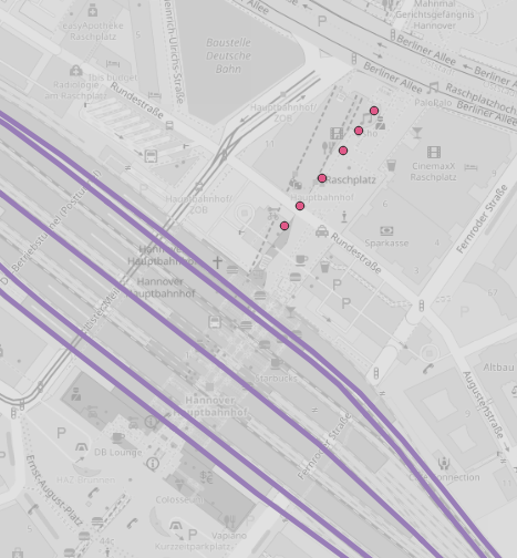
This is elevator dataset (http://data.deutschebahn.com/dataset/data-aufzug) in DB_REF assumed CRS is EPSG:5683, compared with OSM tiles and railway line network (http://data.deutschebahn.com/dataset/geo-strecke), provided in EPSG:4326 (map projected to EPSG:3857). Elevators should be placed on the platforms, between the lines.
Same offset issue occurs when I attempt to save my own data in DB_REF using QGIS - they get an offset to external DB_REF data.
Am I missing any DB_REF CRS? Or could the DB_REF definitions used by QGIS be wrong?
EPSG codes:
- 1081 Deutsche Bahn Reference System
- 5825 DB_REF geocentic
- 5826 DB_REF to ETRS89
- 5681 DB_REF geografic 2D
- 5830 DB_REF geografic 3D
- DB_REF / 3-degree Gauß-Krüger
- 5682 zone 2 (E-N)
- 5683 zone 3 (E-N)
- 5684 zone 4 (E-N)
- 5685 zone 5 (E-N)
- DB_REF / 3-degree Gauß-Krüger+DHHN92 height
- 5832 zone 2 (E-N)
- 5833 zone 3 (E-N)
- 5834 zone 4 (E-N)
- 5835 zone 5 (E-N)

