1

I have a raster data where pixel value of each cell represents the potential minimum travel time across the cell in old world. I need to find the minimum travel time of some points from Addis Ababa (Ethiopia) in ArcMap.

So I use Cost Distance to generate the raster with the least accumulative travel time for each cell. However, the generated raster doesn't make sense. For example, in the original raster, the source cell (i.e. including Addis Ababa) has the value of 0.263932, and its neighbor cell has the value of 0.194596, but the pixel value of the neighbor cell in the generated raster is 0.003143 !!!

I am using ArcMap 10.6. The coordinate system of the raster data is WGS_1984.

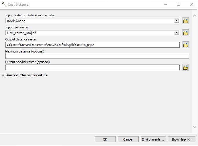
What am I doing wrong? Here is a screen shot of the tool.

enter image description here

2 Answers 2

2

The output is in Decimal Degrees because your input dataset is in WGS84. If you project your data into a coordinate system using metres then the cost distance output will make much more sense. Have a play with this Projection Wizard to help you choose an appropriate projected coordinate system.

3
  • But then I get a measure in meters which again doesn't make sense because cell values are number of hours/days to travel across the cell.
    – D_B
    Commented Feb 12, 2019 at 18:08
  • 1
    May be you need to read the help file to understand the output, suggest you look at the page titled "How cost distance tools work"?
    – Hornbydd
    Commented Feb 12, 2019 at 18:48
  • Thanks! I had read it before. It doesn't explain why I get two additional decimal points for the accumulative values when using WGS84.
    – D_B
    Commented Feb 13, 2019 at 1:45
1

OK! The reason is that in Cost Distance, each cell location value is multiplied by the cell resolution while also compensating for diagonal movement to obtain the total cost of passing through the cell.

So I just needed to use projected raster (WGS_1984_Cylindrical_Equal_Area), and divide the output raster by the cell size.

Your Answer

By clicking “Post Your Answer”, you agree to our terms of service and acknowledge you have read our privacy policy.

Not the answer you're looking for? Browse other questions tagged or ask your own question.