1

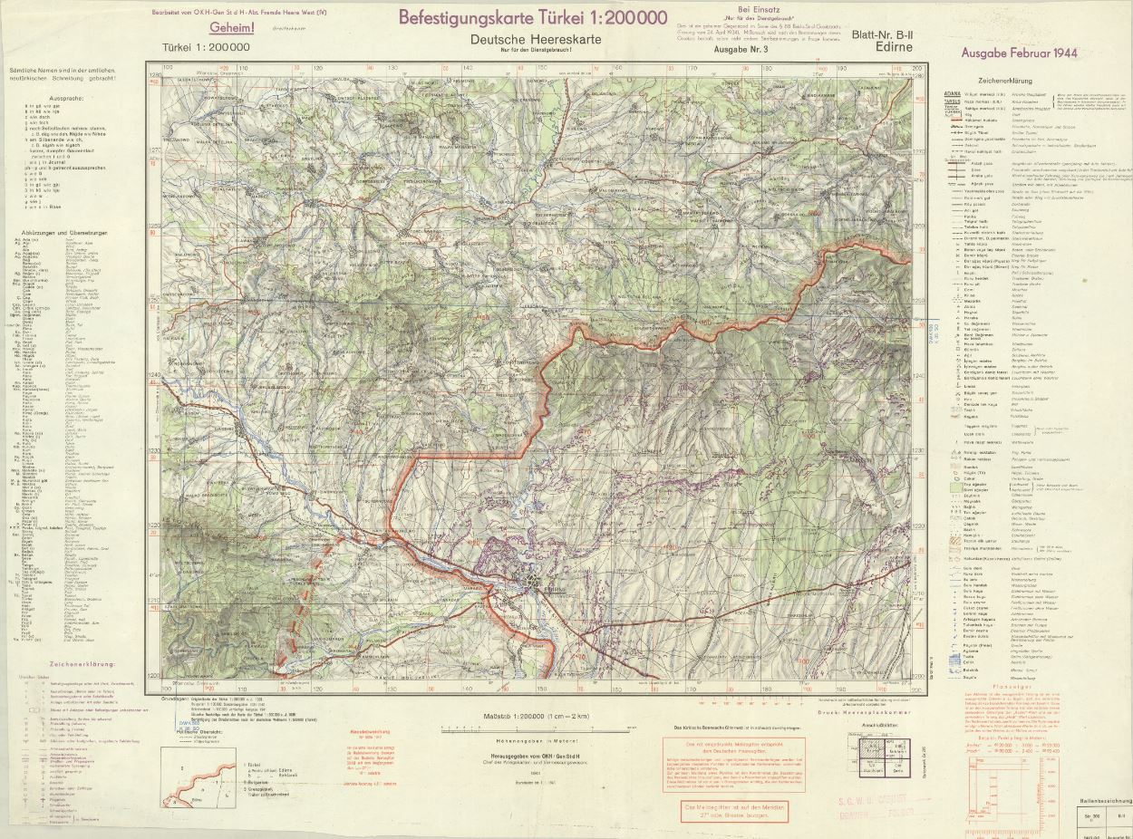
I am trying to geo-reference a series of maps of the German Military service in ArcMap or ArcGIS Pro using the coordinate grid (in red) provided by the German Military during the WWII. The attached map is an example of the maps (125 in total) which I would like to digitize. While I have some experience in geo-referencing maps, it is the first time I am using an original grid of the map to do so.

As far as I understood so far, in order to enter the coordinates displayed on the map. I should first understand the original georeferencing system. However, unfortunately so far I have not been able to find its history.

Are there perhaps other correct methods to digitize these maps?

How would you go about digitizing these maps?

Map Example

3
  • 1
    Welcome to GIS.SE. Somewhere on this map there should be a note, which CRS was used. Once you have that, the rest is piece of cake.
    – Erik
    Commented Apr 8, 2019 at 9:30
  • 1
    Thank you @Erik Unfortunately I could not find Reference System on the map itself. They are from 1940s so I am not sure which one to use. To give some more sample material, at this site there are 16 sheets publicly available.
    – PGerrits
    Commented Apr 8, 2019 at 9:47
  • 1
    I suggest you start with one of the Gauss-Kruger projections you can find on epsg.io: epsg.io/?q=turkey&=search. These are old style transversal Mercator projections that were used on Balkans in the times of Austro-Hungarian Empire.
    – TomazicM
    Commented Apr 8, 2019 at 11:17

1 Answer 1

4

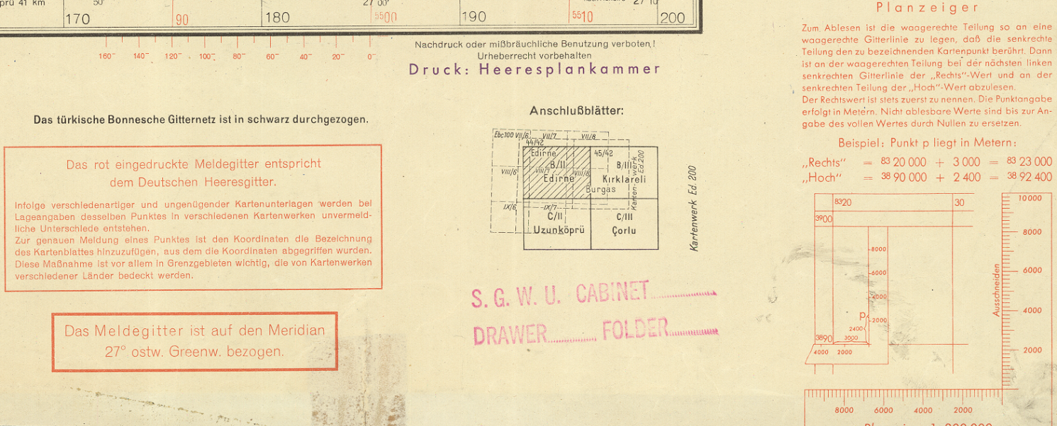
At the bottom right there's some red text. In the corner it tells you how to read coordinates off the map (basically its an early UTM) while a bit to the left it tells you, also in red, that the red grid is the "Deutsches Heeresgitter" centered around 27° E (it's based on the Bessel ellipsoid, similar to DHDN, but older). In black above this it says, that the black grid is the "turkish Bonnesche grid" (never heard of this one). enter image description here

So either you do some research on one of these, or you use the degrees which are noted at the map borders - depending on how exact you would need the digitalisation to be.

1

Your Answer

By clicking “Post Your Answer”, you agree to our terms of service and acknowledge you have read our privacy policy.

Not the answer you're looking for? Browse other questions tagged or ask your own question.