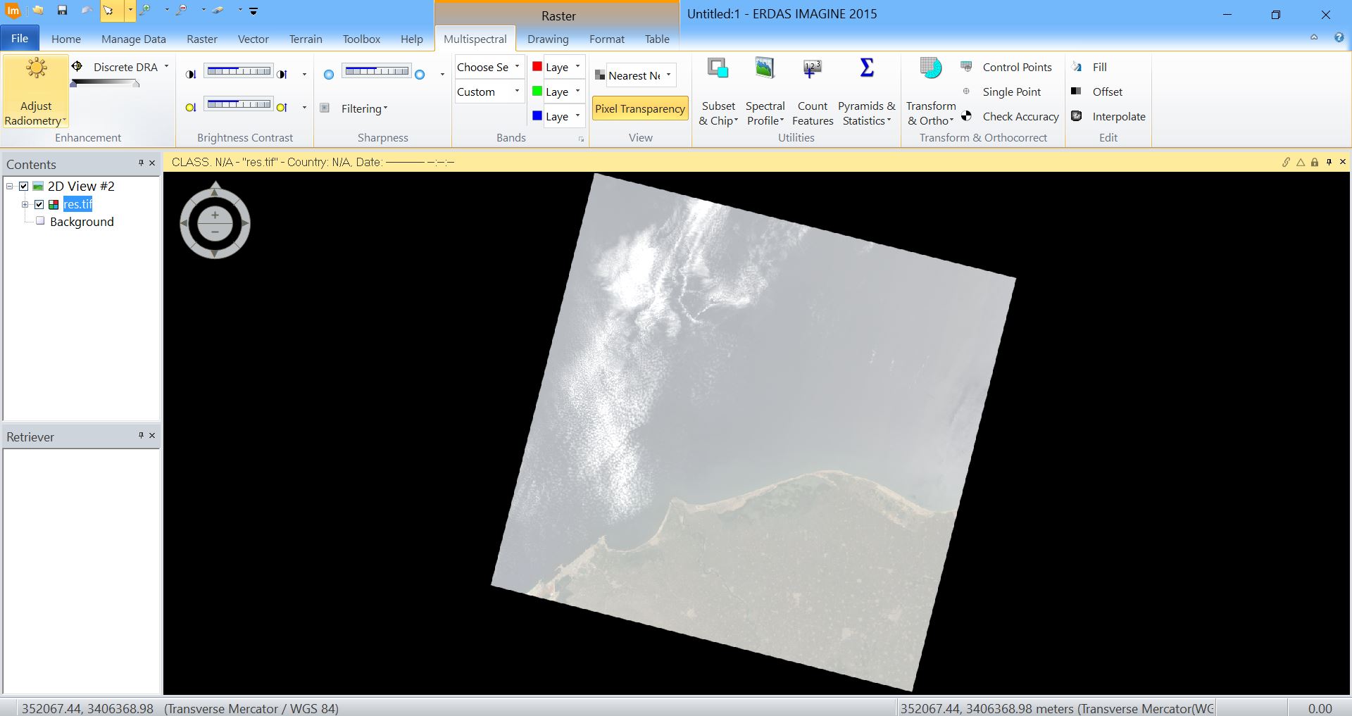
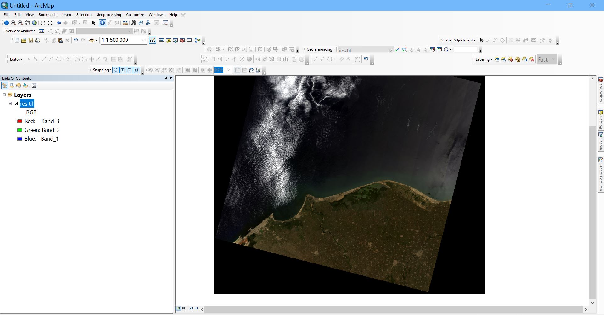
I have a raster that is formed by stacking the bands blue, green and red of "Landsat 8", when it is displayed on Erdas Imagine 2015 it appears as if there is a semi-transparent grey layer over it, the raster itself has no problems as I displayed it on ArcMap and it appears normal.
-
1Check your display properties in both. Esri will detect that there isn't much range in the image (mostly high numbers by the looks of it) and apply a gamma correction by default with a stretch of percent clip. It also looks like you need to set your NoData to 0,0,0 to lighten up the statistics in Esri - the dominance of the black border is dragging your mean down.– Michael StimsonCommented Nov 27, 2019 at 0:14
Add a comment
|


