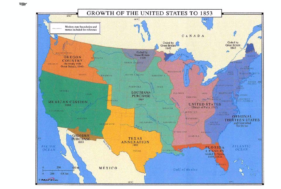
I am having a problem. I follow the steps to try to georeferenced, but I see that the JPEG is much bigger than the shapefile when you add both to the table of contents. I try changing the extent on one, but it doesn't make it match the other. I tried setting extent to data frame, but it still does not change it. I am trying to georeferenced a JPEG map of the U.S. territorial acquisition to a shapefile downloaded of the U.S. The JPEG map shows up so much bigger than the shapefile that I cannot even see the shapefile to make any control points or anything. Here is a snapshot of the problem. It is just about impossible to see the U.S. shapefile in the background, but if you look carefully at the top left corner you can see it. There is no way for me to georeference this image because the image is way too big compared to the shapefile, and nothing seems to change if I try to change the extent.

-
1Please add the GIS software you are using.– Mapperz ♦Commented May 25, 2020 at 20:21
-
1I am using ArcGIS Desktop 10.5– EBeeCommented May 25, 2020 at 21:33
-
1tagged 'ArcGIS-Desktop'– Mapperz ♦Commented May 25, 2020 at 21:35
1 Answer
You don't state what kind of software you use - let's guess it's QGIS?
It seems you have loaded your JPG map directly to the QGIS map canvas. You can't do this, you first have to georeference your image. To do that, use the Georeferencer Plugin (it's a core plugin, so you just have to activate it in the Plugins-menu) and than load the JPG map you wish to georeference there. See here for the documentation: https://docs.qgis.org/3.10/en/docs/user_manual/plugins/core_plugins/plugins_georeferencer.html
There are quite some tutorials out there that show you in detail how to georeference, including videos - e.g. this one here by Klas Karlsson: https://www.youtube.com/watch?v=t1X1U8255Q0
-
-
I guess its similar in ArcGIS. Watch out for a tutorial how to georeference– BabelCommented May 26, 2020 at 7:11
