STEP-1
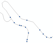
I used the Create Routes (Linear Referencing) Tool to create the Routes from the polyline layer (my roads)
STEP-2
I used the Locate Features Along Routs (Linear Referencing) Tool to locate the points in sequence along the roads-polylines.
This created the filed MEAS in the layer
This tool resulted to a .dbf Table which had to be displayed by the X,Y data to import it as Events layer.
Then this Events layer was exported as .shp file in order to use it for creating lines from the points which are now in sequence along the roads.
STEP-3
I continued with the Step-3 of @Taras from my initial Question [Projecting polygons into polyline] Projecting polygons into polyline.
In particular for ArcGIS, I used the Points To Line (Data Management) Tool.
I used MEAS at the Line Field
STEP-4
a) I had to Split the resulted line layer into the segments-lines because at the Attributes Table there was showing only one feature
b) At the Attributes Table also, I Added their Length field and Calculated the Geometry
b) I sorted the lines by their length
c) I selected those lines longer than my requirement (35.68m in my case) and deleted them together with other unsuitable lines created.
STEP-5
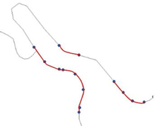
I Dissolved the remaining lines to create segments-polylines in order to create one buffer for each segment at the next Step.
The parameters used for dissolving the line features included:
Road for the Dissolve_Field(s), Create multipart features, and Unsplit lines
STEP-6
Then I was able to continue with the Step-4 of @Taras from my initial Question [Projecting polygons into polyline] Projecting polygons into polyline.
I used the Buffer (Analysis) Tool, with the settings: 3.5m for the Linear unit, FULL for the Side Type, FLAT for End Type
STEP-7
Finally I Intersected the polyline-road layer with the buffer layer to get the segments of interest.


