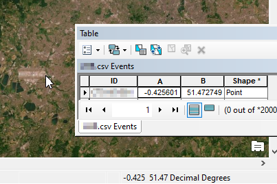
I have imported a csv into ArcGIS, then displayed xy data. For some unknown reason to me, the point are plotting incorrectly. I am using an ESRI base map in WGS 84 web mercator aux sphere and the display is set to decimal degrees. When I mouse over the correct position in ArcGIS the bottom right coordinates of the mouse match the imported csv properties.

If I search using the coordinates in Find locations in ArcGIS, it plots indicates correctly, but the same point imported in via a csv does not as shown in the below image:
Anyone have any suggestions?

