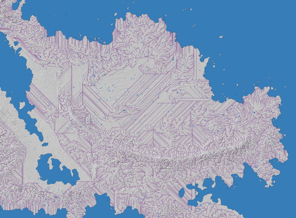
I'm having a rather horrible issue where my rivers decide to be straight lines instead of following the DEM I am using. Can someone explain why this is happening, and what I can do to solve this problem aside from manually routing rivers?
UPDATE: Using a Low Pass Filter allowed expected channels to be created in the lower areas of the map, but prevented them from generating at higher elevations at all.
UPDATE 2: Due to GRASS's r.watersheds crashing QGIS when I try to use it, I am using SAGA's Channels tools.
Solution: r.watersheds can be run outside of QGIS using GRASS as a standalone program. This works on windows in spite of r.watershed hanging infinitely within QGIS.

