I would like to develop an expression that does the following nearest-neighbour analysis:
From a layer of points 'point_layer', I would like to calculate for each point the distance to the nearest point.
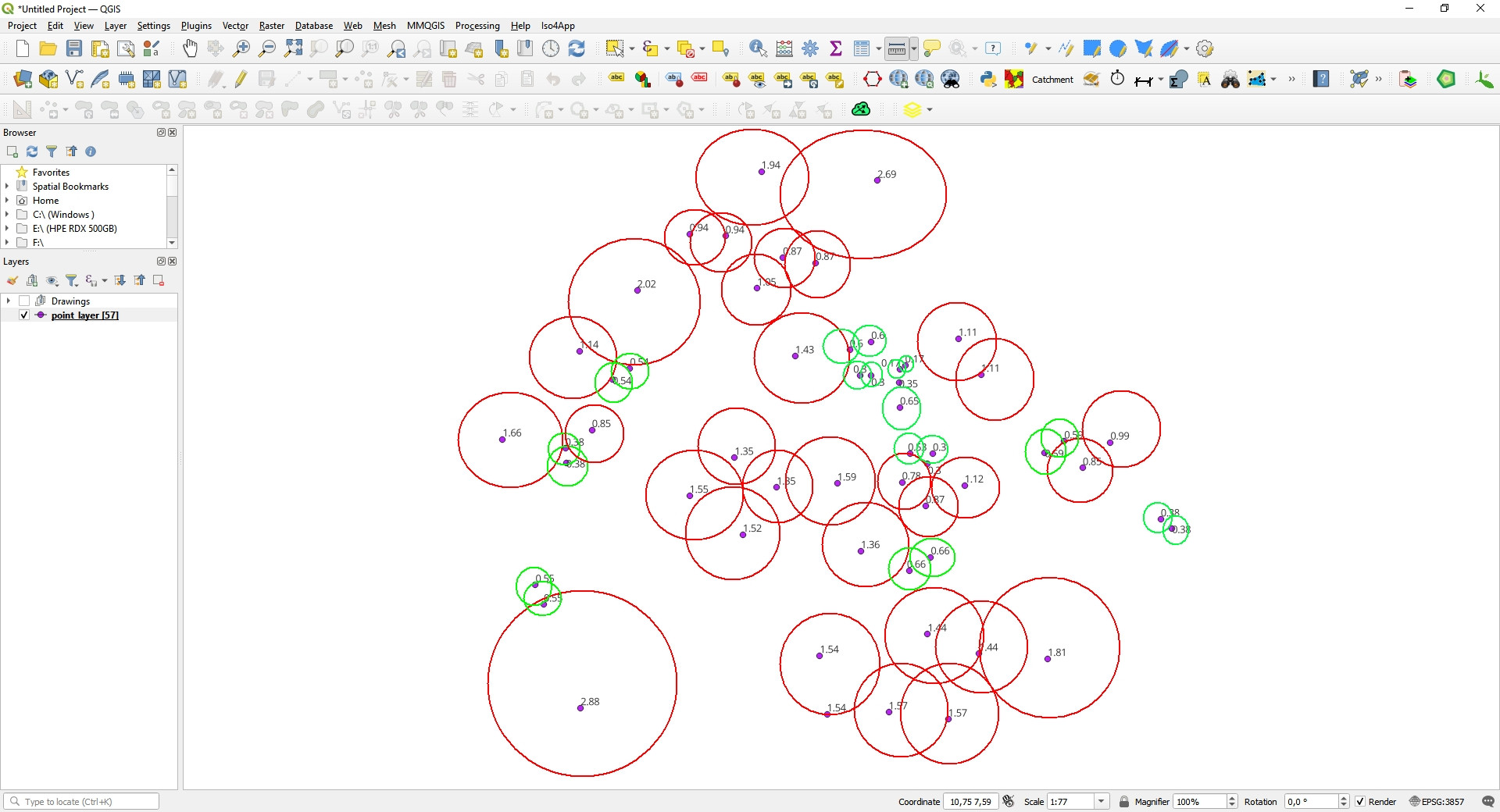
Once this distance value is calculated, the goal is to draw the buffer with the distance as a radius value and then symbolize the buffers with two categories:
- Red green: points (buffers) located within 70 centimetres
- Red red: points (buffers) located outside of 70 centimetres
Below I show a manual result recreation that should be obtained:
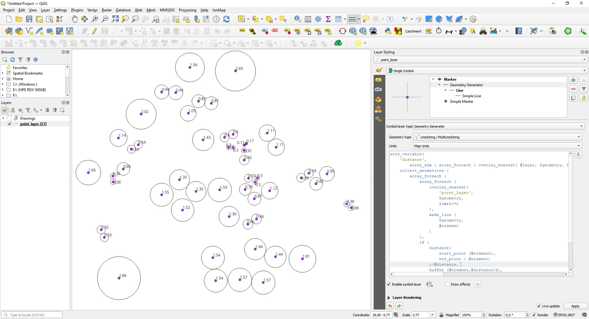
For my part, to try to obtain the expected result, I am working on this idea:
To obtain the closest distances to each point I use the following function:
array_sum (array_foreach (overlay_nearest(@layer, $geometry, limit:=2), length (make_line ( $geometry, @element))))
In this step, it seems that the result is correct, but it is not clear to me that it is necessary to use the function array_sum.
- Then I use the Geometry generator with the following expression that tries to integrate the previous function of distance calculation with the creation of buffers:
with_variable(
    'distance',
        array_sum ( array_foreach ( overlay_nearest( @layer, $geometry, limit:=2), length (make_line ($geometry, @element)))),
    collect_geometries(
        array_foreach(array_foreach(
                overlay_nearest(
                    'point_layer',
                    $geometry,
                    limit:=1),
                make_line(
                    $geometry,
                    @element)),
            if (
                distance(
                    start_point (@element),
                    end_point ( @element))<@distance,
                buffer (@element,@distance/2),
                buffer (@element,-@distance)))))
As you can see, with this expression I manage to draw the buffers. This is just a working idea.
Can you help with a new approach to enable me to complete the goal?
Previous result:
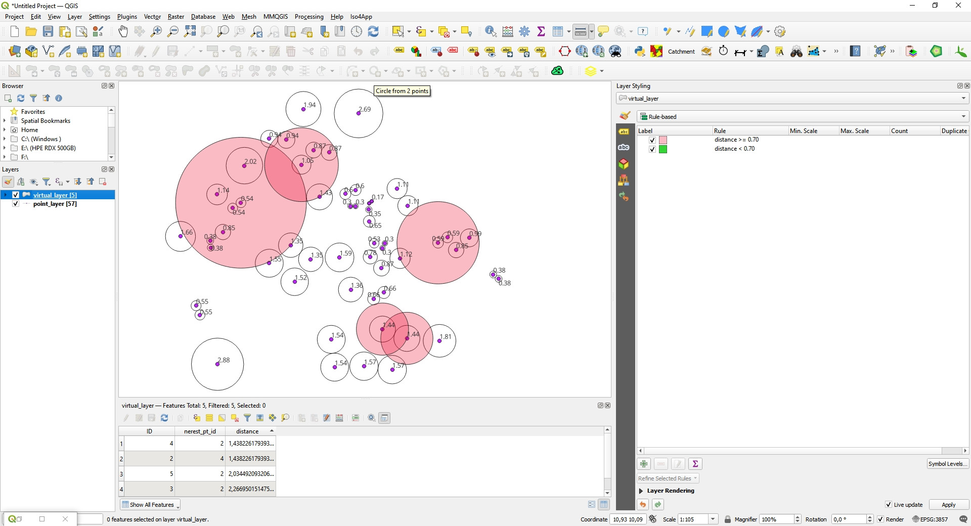
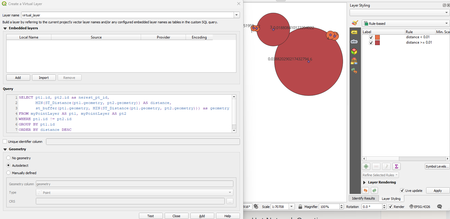
Attempt to implement the solution by @JGH user
I have implemented the solution proposed by user @JGH but it does not give the expected result. It seems that the virtual layer only loads 5 points:
It seems to be calculating the cumulative distance of 5 points. I am not sure.
It seems also that the distance values are too high.

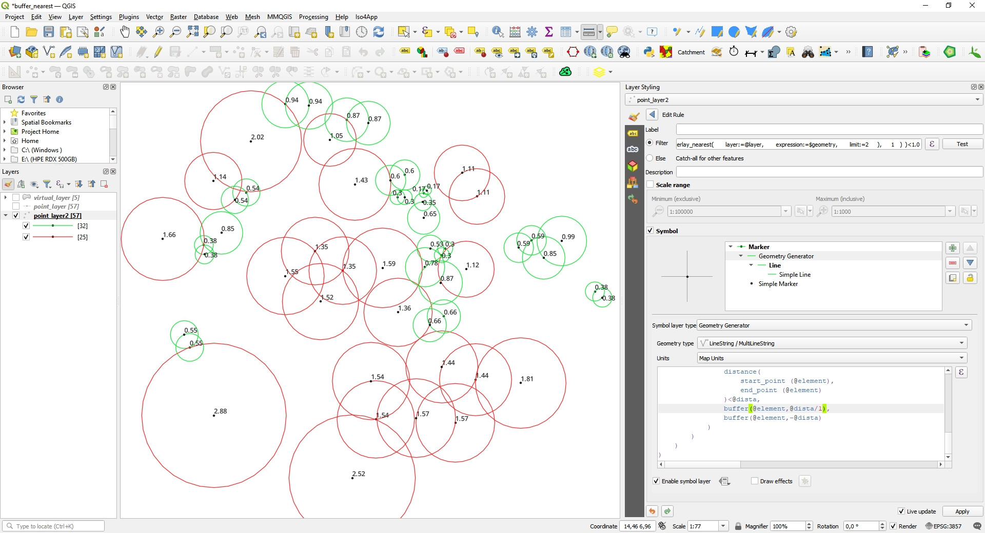
3857. Use a suitable local projection that preserve distances (UTM or else). Also make sure each point has its own ID (no duplicates)