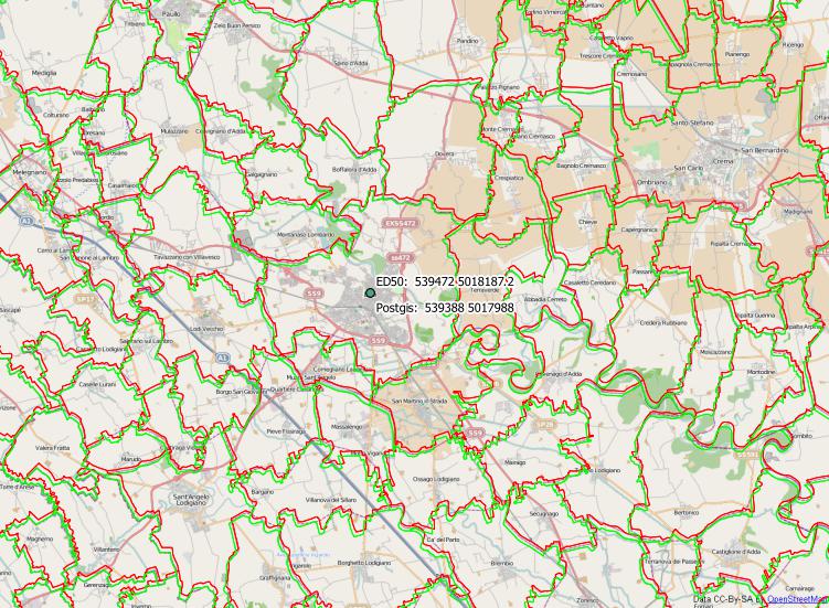
With an offset of around 200 metres, it looks like a missing data shift.
Your target SRS is exactly WGS84, that is +towgs84=0,0,0,0,0,0,0
If I create a raster grid with ED50 UTM 32 EPSG:23032, it is shifted 200m to the south and 80m to the west to the WGS84 UTM 32 grid.
The shift parameter of ED50 is +towgs84=-87,-98,-121,0,0,0,0
To see which of your layers is right, you can change the project SRS to EPSG:3857, install open layers plugin, load Google or Openstreetmap background and see which layers are well aligned to that.
Most probably the false layers must be assigned to EPSG:23032.
Please do not reproject the data to EPSG:23032, because this will change the coordinates, but will not shift the data. Instead you have to assign that CRS.
On-the-fly-transformation should be switched on.
EDIT
If the background data is from istat.it, it will most probably be in ED50-UTM32N, according to this document. Here is a small example of the border data in right (green) and wrong (red) CRS:


