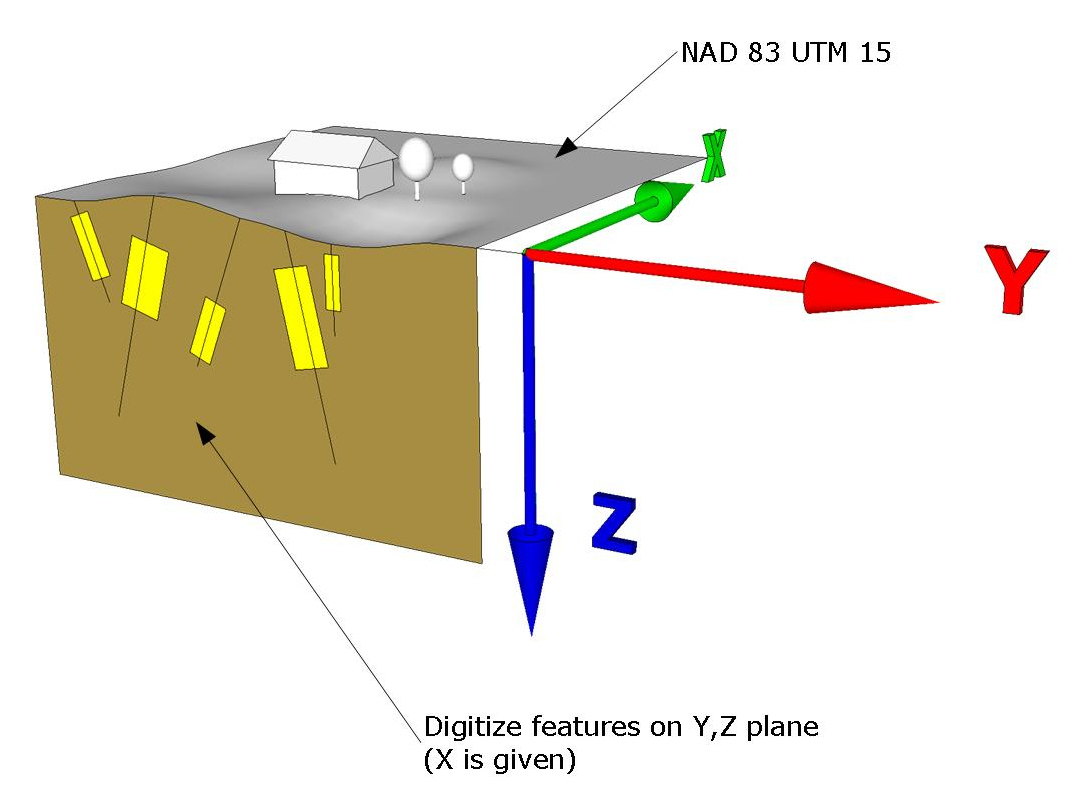
How can I geo-reference and digitize features on a Y,Z plane of a vertical cross-section in ArcGIS?
The surface coordinate system is NAD 83 UTM 15.
 This is a simplified version of the question found here:
How to digitize directional drilholes from scanned vertical sections?
-
2What form does the output need to be in, Jakub? 3D vector objects? 3D coordinates for selected points? 2D coordinates at the surface plus depth and orientation? Something else?– whuberCommented Mar 7, 2011 at 4:53
-
The desired output is a file of 2D polylines and polygons referenced to a Y,Z coordinate system (Y same as the surface coordinate (NAD 83 UTM 15) and Z coordinate in metres) No 3rd dimension or volume is required.– Jakub Sisak GeoGraphicsCommented Mar 7, 2011 at 14:37
-
The goal is to create slices from interpreted geological contacts of a series of vertical cross sections. These "slices" (polygons) will be then exported into GEMS (Gemcom) and used for creating 3d solids.– Jakub Sisak GeoGraphicsCommented Apr 21, 2011 at 1:08
3 Answers
* Make sure the 3D Editor toolbar is already added to your display.
  Click Customize > Toolbars if you need to add it.
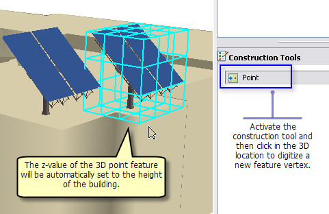
* Digitizing 3D feature vertices is supported for points, lines, and polygons.
Steps:
- Start ArcScene or ArcGlobe and add the 3D feature class (pointZ, lineZ, polygonZ) you want to create new features for.
- Add any other base layers you need to complete your digitizing. For example, any surface or building (extruded polygons or multipatches) layers on which you want to place the new 3D feature vertices.
- Optionally add any imagery that you want to use as the backdrop for digitizing. Sometimes an image draped on the surface can make the view more realistic.
- On the 3D Editor toolbar, click the 3D Editor drop-down and click Start Editing. If the layers in your table of contents come from more than one source, you may be prompted to choose the layer or workspace to edit.
- If you prefer, now would be a good time to open the Snapping Environment window to set snapping properties. Open the window by clicking 3D Editor, expand the Snapping side menu, then click Snapping window.
- Choose a feature template and select the edit construction tool from the Create Features window. Be sure to click within the extent of your work area. If you are zoomed out too far from the layer's extent, the feature vertex will not be created. Use CTRL+Z at any time to undo the last edit, for example, to remove the last segment of the line you just digitized.

(can be negative=underground vaules)
Finally >> Convert to 2D Polyline
-
1Thank you for the extensive answer. The features I need to digitize only exist on a profile cross section scans. How can I geo-reference this image on an Y,Z plane? (The scans include coordinate system grid) Commented Mar 8, 2011 at 1:40
After disappointing results in other software packages, I created a workflow to build geology cross sections with the ability to display deviated and inclined downhole data, and digitizing lithology contacts in ArcGIS.
I am now re-mapping downhole surveys to view the data in East to West and South to North sectional views. (When importing points map X = Y and Y = Z and using unknown coordinate system set to metres for unit.) Adding 3D DXF subsurface objects is a bit tricky but after converting these models to point clouds and adding XYZ coordinates (I densifying the 3D mesh lines to get more contact points to digitize from) I can the remap the XYZ and query for a range of easting or northing values (however the section is oriented). This gives me a selection of points on the perimeter of the contact. I had to create (and will create more to automate the process further) a few add-ins. 1. to convert mesh lines to 3D points using al vertices, 2. creating a coordinate grid i can use on the sections. (Northing, Elevation)
It's not the most dynamic process but afer i write a few tools for updating new drillholes it will hopefully get easier.
Try the script here: http://www.spatialhydro.com/scripts.html It converts digitized 2d cross sections to 3d coordinates.
