1

This problem, that I have also been struggling with, in QGIS 1.7.3 as well.

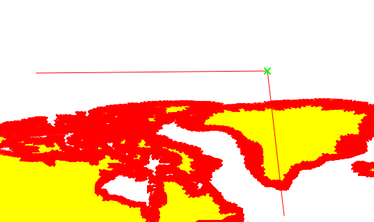
Here are the steps to reproduce the problem:

1)Download Natural Earth 10m land shapefile from original website.

*2)*Open the file as vector shapefile in QGIS.

*3)*On layer browser, right click and enable "Toggle Editing"

*4)*Press button "Select single feature by click", then click on the piece of land (becomes yellow)

*5)*Click "Split Feature" scissors button.

At this point the land layer disappears, (the map display goes white, but land layer is still on layer browser though) and the "Toggle Editing" is disabled without me doing anything.

As soon as I re-enable editing, the map comes back.

Other features like drawing polygons function normally.

Thanks in advance.

2
  • Have you tried with other polygon files?
    – underdark
    Commented Sep 26, 2013 at 18:48
  • Are the CRS of the layer and canvas the same? Is On The Fly Transformation turned on?
    – Willy
    Commented Sep 27, 2013 at 4:13

2 Answers 2

2

If you are talking about just the steps to create the cut line.
There may be some problem with resources. Mine works fine.

split tool
If you are talking about getting the cut line created and then when you finalize. mine did take a while. but then a dialog came up (not in the foreground [I had to toggle alt+tab])
that says...
dialog

So after looking at the dataset. there is only one polygon, after running the multipart to single part there 4008 features but they all have the same values.
But there are other datasets that already have these countries defined in the attributes.

0

Funny thing...

I though THIS was the split feature:cut feature button While the actual one was: split feature button

And the reason the layer's gone as I told you, was because the layer was cut, not splitted.

Sorry for taking your time in this confusion..

Your Answer

By clicking “Post Your Answer”, you agree to our terms of service and acknowledge you have read our privacy policy.

Not the answer you're looking for? Browse other questions tagged or ask your own question.