3

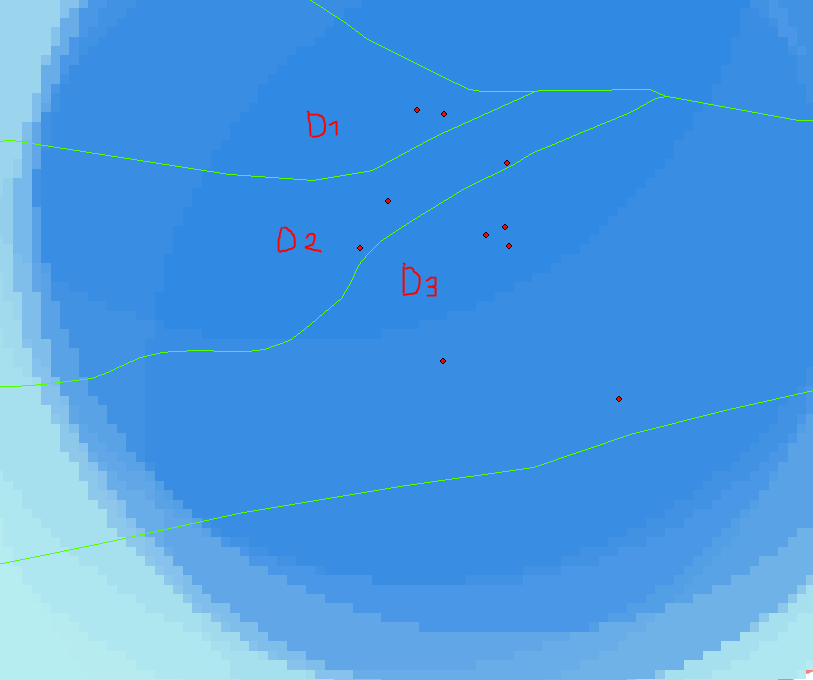
I interpolated the age of minerals for the Inner Tien Shan mountains (Kyrgyzstan) using the ArcGIS tool "spline with barriers". I use ~ 200 points for my interpolation. The barrier that I use is a fault map (polylines, green in example). For my further interpretations, I would like to estimate the quality of my interpolation. At the moment I am using the point density for this purpose, but this is only correct for regions where no barriers are (see example below).

Is there a solution, where I can calculate the point density with taking my barriers into account or are there maybe different approaches to estimate the quality of my interpolation?

Example:

Here D1,D2 and D3 have all the same point density of 36.5%, whereas my interpolation quality is different in each region.
enter image description here

2 Answers 2

2

What you need to do is to separate a part of your input points (at least 10% of your data), then with the 90% data interpolate your variable (in your case spline with barriers).

After that you must validate your results using RMSE for example, save the 10% of your data in a new shapefile and use extract values to points in the toolbox (spatial analyst->Extraction). You can find the RMSE equation in this site.

1

I don't think that interpolation between points, unless you have really good coverage will work for minerals age. It seems that proximity polygons inside individual areas will do better job. With spare coverage it is worth to consider methods developed by Hutchinson (Australian university), where cotinious raster of something helps interpolate values at XY points. Climatologist often use elevation model as such raster to help with temperature mapping. The trick is to find raster, e.g. depth to the layer in your case? Privet Tian-Shanyu...

4
  • Thank you FelixIP for your answer. I will defenitely consider you idea with proximity polygons. I haven't thougth about this. Do you have recommondation for a tool in ArcGIS that achieves this?
    – Valentin
    Commented Sep 1, 2014 at 13:52
  • I think the topo2Raster tool is based on the algorithm of Hutchinson. The problem here is, that I cannot implement barriers in the interpolation. And what do you exactely mean by "depth to the layer"?
    – Valentin
    Commented Sep 1, 2014 at 13:58
  • Yes it does, but what I am talking here is not a part of ArcGIS fennerschool.anu.edu.au/research/products/…
    – FelixIP
    Commented Sep 1, 2014 at 20:23
  • 1
    Oops, skipped your first comment. It is Voronoi polygons resources.arcgis.com/en/help/main/10.1/index.html#//…
    – FelixIP
    Commented Sep 1, 2014 at 23:42

Your Answer

By clicking “Post Your Answer”, you agree to our terms of service and acknowledge you have read our privacy policy.

Not the answer you're looking for? Browse other questions tagged or ask your own question.