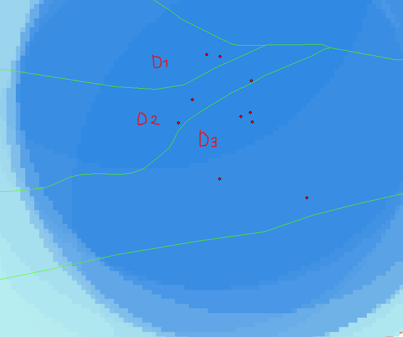
I interpolated the age of minerals for the Inner Tien Shan mountains (Kyrgyzstan) using the ArcGIS tool "spline with barriers". I use ~ 200 points for my interpolation. The barrier that I use is a fault map (polylines, green in example). For my further interpretations, I would like to estimate the quality of my interpolation. At the moment I am using the point density for this purpose, but this is only correct for regions where no barriers are (see example below).
Is there a solution, where I can calculate the point density with taking my barriers into account or are there maybe different approaches to estimate the quality of my interpolation?
Example:
Here D1,D2 and D3 have all the same point density of 36.5%, whereas my interpolation quality is different in each region.

