2

I am extremely new to GIS and I just received a shapefile, as a zip file that includes the following files:

filename.SHX
filename.SHP
filename.prj
filename.dbf
filename.cpg

but I am not sure how I would display this data.

Is there anything else needed?

I just installed QGIS on a Debian box, but I guess it won't run, because it's just CLI, with no display environment.

6
  • I install xorg-dev on Ubuntu, then ensure my ssh client enables X-forwarding, then qgis will start. I don't use Debian but it will have a similar way.
    – mdsumner
    Commented Nov 26, 2014 at 19:48
  • i just installed the xorg-dev, but when i try to run qgis i get the following error: QGIS starting in non-interactive mode not supported. You are seeing this message most likely because you have no DISPLAY environment variable set. Commented Nov 26, 2014 at 20:16
  • Sorry I gave you bad infro, got reader an dexplorer mixed up esri.com/software/arcgis/explorer-desktop use qgis You need explorer Commented Nov 26, 2014 at 21:13
  • Does your ssh client allow X-forwarding? It's the -X argument to ssh, or some setting on the interface, or as it states the configuration of your client DISPLAY.
    – mdsumner
    Commented Nov 26, 2014 at 21:45
  • I think this question would be better focussed on "How to get QGIS running under Debian?" because until you have that or some other GIS software running that can display shapefiles the shapefiles will be of no use to you.
    – PolyGeo
    Commented Nov 27, 2014 at 9:47

1 Answer 1

3

Yes this is a standard GIS shapefile. A shapefile is a bit of a misnomer as it contains between 3 and up to 10 parts. You have all the correct parts.

You can install QGIS on ubuntu easy enough https://www.qgis.org/en/site/forusers/alldownloads.html

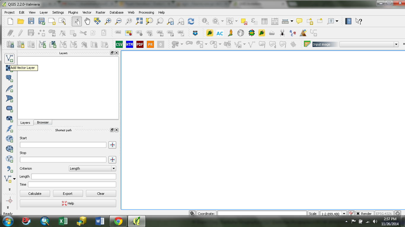
It works on linux or windows, once installed you need to add a vector layer..

Use the this to add your data screenshot

To just view the data Explorer is an alternate and works on windows

12
  • 3
    You can even drag and drop the .shp file (not the others) into the Layers field (at least on Windows).
    – AndreJ
    Commented Nov 26, 2014 at 20:05
  • @AndreJ. Ooh, cool, didn't know that one. Drag n Drop works on Ubuntu with QGIS 2.6 also, I can confirm. Commented Nov 26, 2014 at 20:12
  • ArcReader works on Linux. Yee gads, what blasphemy is this. Commented Nov 26, 2014 at 20:16
  • ok once i have this loaded, what i am ultimately trying to do is display this in a php page, i'm not sure if its even possible to do that, since this seems to be like a desktop app, and not sure if i can make it displayable on the web Commented Nov 26, 2014 at 20:21
  • 2
    I screwed up I listed reader but meant explorer answer updated, just use qgis Commented Nov 26, 2014 at 21:15

Your Answer

By clicking “Post Your Answer”, you agree to our terms of service and acknowledge you have read our privacy policy.

Not the answer you're looking for? Browse other questions tagged or ask your own question.