3

I have some Points in Shapefile with BC Albers Coordinate Syetem and I need to Project them to Google Maps Lat and Long. I tried to do this by using

WGS 84 / Pseudo Mercator EPSG: 3857

and

WGS84 EPSG: 4326

But none of them returning correct result! I believe there is Coordinate for Google Maps in ArcGIS as "Web Mercator" to do this but I couldn't find it in QGis.

What Coordinate should I use for Getting correct points X and Y on google map?

I also used EPSG:900913 Google Mercator but when I tried to get X and Y coords through Geometry Tool/ Export add Geometry Columns I am getting numbers like :

enter image description here

Result using EPSG:3857:

enter image description here

7
  • If you're looking for lat/longs, then 4326 is your destination coordinate system.
    – Mintx
    Commented Jan 30, 2015 at 20:37
  • Thanks Mintx 4326 looks more like lat and long but what I am getting are wrong coordinates!
    – Suffii
    Commented Jan 30, 2015 at 20:53
  • Could you give an example of a coordinate before and after converting?
    – Mintx
    Commented Jan 30, 2015 at 20:55
  • Like actual file?
    – Suffii
    Commented Jan 30, 2015 at 20:55
  • It looks like some of your source coordinates are swapped. If the area of interest isn't too large and should relatively near Vancouver, all x values should be >1 million. Thus point 1, 9, 13, etc need their values swapped.
    – mkennedy
    Commented Jan 30, 2015 at 21:01

1 Answer 1

2

What you need to do is first display your CSV in the proper coordinate system (BC Albers) so QGIS can then re-project it to Google Maps Mercator (3857).

EPSG:3857 -- WGS84 Web Mercator (Auxiliary Sphere) is what you want.

So what you need to do is add your CSV to QGIS using 'Layer > Add Layer > Add Delimited Text Layer'.

Choose the default options in the first window:

enter image description here

The next window will ask you what coordinate system you want to use to display your X and Y values. You know it is in BC Albers, so choose that option in the dialogue box:
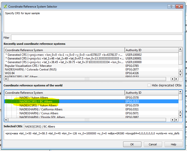
enter image description here

Now your points - still in BC Albers - will display in QGIS - but this is tricky because you will have a hard time displaying the various OpenLayers backgrounds with this data.

Here are the points on their own:
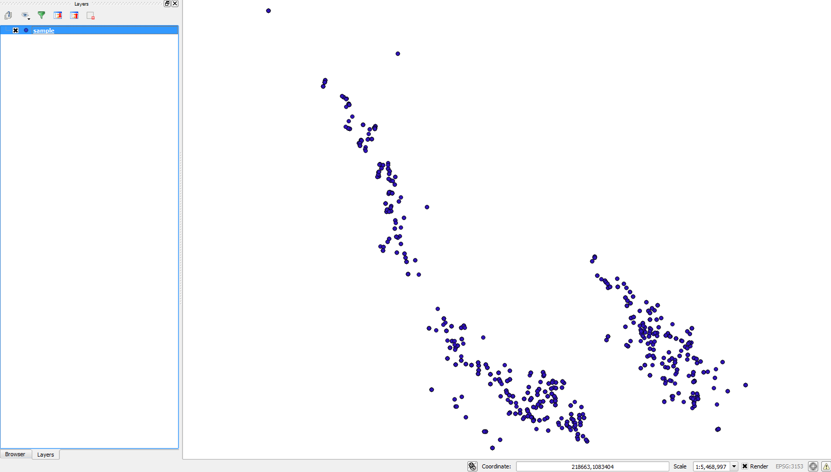
enter image description here

The last step is to actually re-project your data to Google Maps projection

Right-click the sample (CSV / delimited) layer in QGIS > Save As

Format: ESRI Shapefile
Save as: give your new SHP a name
CRS: Selected CRS > choose EPSG:3857 WGS84 / Psuedo Mercator**

Click OK to export and re-project your CSV to SHP in 3857

Now create a new map (to reset the coordinate system of the QGIS project)

Add your SHP you saved, and from the Web > OpenLayers menu add one of the basemaps:
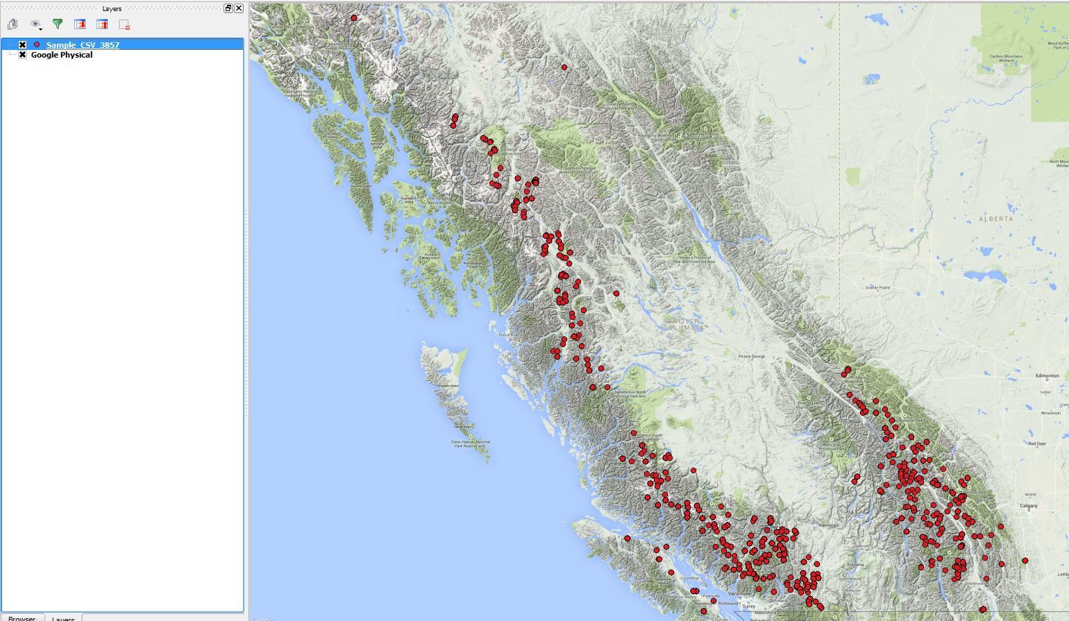
enter image description here

That should do it!

Updates:

**The difference between EPSG:3857 and EPSG:3785 in QGIS is confusing, and I'm not exactly sure what the purpose of 3785 is... Most if not all web map systems are published using EPSG:3857 yet in QGIS the description for 3785 is "Popular Visualization CRS / Mercator" and the description for the CORRECT web mercator is "WGS 84 / Pseudo Mercator". I will take up this issue somewhere else!

Update #2: I see in this thread that 3785 is the deprecated version of the 'google maps' coordinate system... I hope QGIS can make note of this soon...

4
  • Thanks MapBaker but I am not getting Correct value for X and Y at EPSG:3857!
    – Suffii
    Commented Jan 30, 2015 at 20:26
  • I uploaded an image showing the result of X and Y at EPSG:3857, can you please take a look at that?
    – Suffii
    Commented Jan 30, 2015 at 20:30
  • @Behseini updated my answer with the correct CRS/EPSG value and the steps to get your data working correctly... Commented Jan 30, 2015 at 21:44
  • @Behseini you are welcome!!! good luck! Commented Jan 30, 2015 at 22:38

Your Answer

By clicking “Post Your Answer”, you agree to our terms of service and acknowledge you have read our privacy policy.

Not the answer you're looking for? Browse other questions tagged or ask your own question.