6

I am working in QGIS 2.10.1 and I have the following situation: I have some Landsat8 scenes (different paths and rows) and I want to extract their boundary. My final objective is to superimpose them to the vector of my study area, so that I can show how the scenes cover the study area and in which points they overlap. I have already tried to convert the raster into a vector, but QGIS cannot make it, it crashes or it gives me back only part of the polygon.

Is there anybody who's got an idea to solve this problem?

8
  • 1
    What workflows are you using to accomplish this? And, if you receive an error, please post the error text in your question.
    – MaryBeth
    Commented Jan 4, 2017 at 14:35
  • At first I was using a stack of raster layers, then I got an error saying that the maximum threshold of 2 GB had been exceeded, so now I am using only one Landsat8 band. I load the band in QGIS, then go to Raster -> Conversion -> Polygonise; I use the raster image as input and then run the tool. However, the output is not a vector covering the area of the raster, but only part of it. In addition to this, I think the result is not a polygon but a polyline, so QGIS has also got difficulties in loading it after creating it... Commented Jan 4, 2017 at 15:00
  • Sounds like image footprint extraction? plugins.qgis.org/plugins/imagefootprint_plugin
    – Mapperz
    Commented Jan 4, 2017 at 15:00
  • 3
    Perhaps try using the Raster Calculator with an expression like "raster@1" = 1. This makes all cells with a value of 1 which might make it easier for QGIS to polygonize...
    – Joseph
    Commented Jan 4, 2017 at 15:18
  • 1
    @Joseph thank you for your suggestion, maybe it's an easy but good one! I will try it as soon as possible :-) Commented Jan 5, 2017 at 17:04

3 Answers 3

2

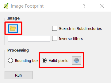
You can use Plugin: Image Footprint as commented by @Mapperz. You need to download the plugin from plugin Manager, and this is how it works:

enter image description here

  1. Specify the folder (directory) where the images are located
  2. Use Valid pixels and specify the CRS of the image.
  3. The outpout will create a virtual vector file with a CRS of WGS84 as the default CRS
  4. You need to Save as the virtual vector file into a permanent file with the correct CRS that should be same as the image file.

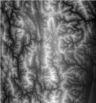
Here is the input image file stored in the folder:

enter image description here

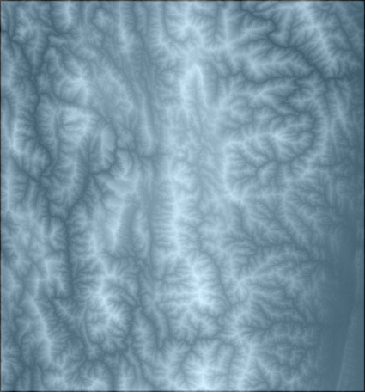
Here is the output footprint:

enter image description here

You can refer to the presentation: Qgis ibama imagefootprint for more information.

1
  • This plugin is deprecated
    – luca76
    Commented Aug 17, 2021 at 11:36
2

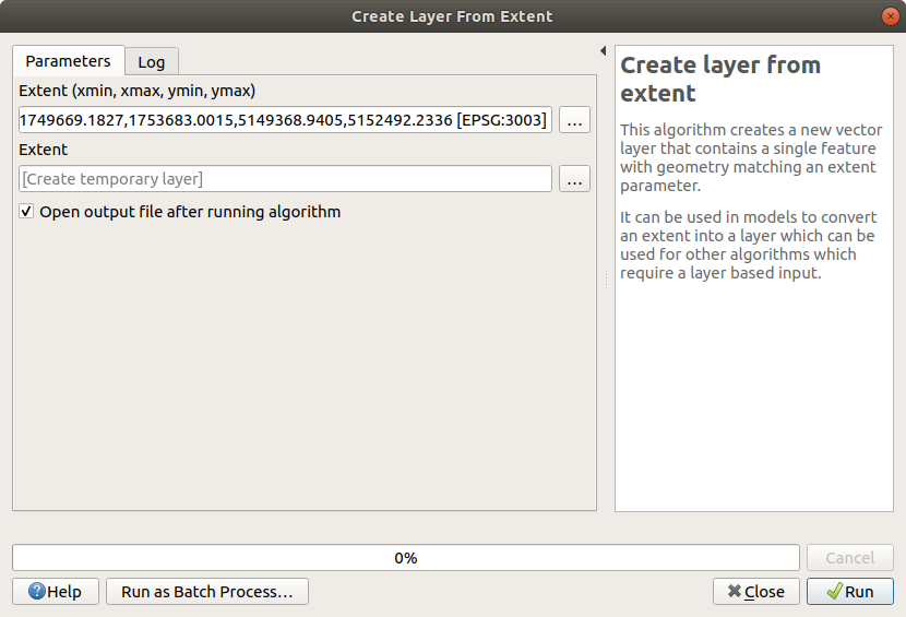
You can use "Create layer from extent" processing algorithm selecting the desired raster layer as extent source

enter image description here

1
  • How to get this window in QGIS 3?
    – zabop
    Commented Jul 8, 2022 at 8:41
1

If you have an alpha channel in you image, you can use GDAL. to be more specific gdal_polygonize.py and use the alpha band to convert to polygon

gdal_polygonize.py image.tif "boundary.shp" -b 4 -f "ESRI Shapefile" None DN

It will return a polygon layer which has two features in it. inside and outside of alpha band. delete the outside and you have an image boundary. GDAL Polygonize

Your Answer

By clicking “Post Your Answer”, you agree to our terms of service and acknowledge you have read our privacy policy.

Not the answer you're looking for? Browse other questions tagged or ask your own question.