6

There are lots of posts to do with QGIS crashing; they tend to deal with specific instances and conditions.

But this has led me to want to know what is a crash minidump?

What is happening, is there a simple answer?

The background leading up to this is that I have a user that has a crash minidump every time that they close QGIS (2.14.9), even though many others are using the same version, on exactly the same machines, of the same age and make without issue.

Then myself, using QGIS 2.16 , I was testing out an answer from Merging attribute and geometric features in QGIS? it gave me a crash minidump each time I tried dissolve vectors. So I decided to uninstall 2.16, and install 2.18

But before I did this I looked for information on crash minidump and yes, the main accepted advice, which works, is to Delete C:\users\name.qgis2 before re-installing

But what is a crash minidump, what’s happening?

Edit added

The user mentioned above, after a of week of no crash mini dump's, is again reporting that the issue is back. Again every time they close QGIS?

What actually causes QGIS to crash? Could it be a hardware issue possibly?

5
  • 1
    I think a very similar question was asked before: Can someone explain to me what the “mini dump” error mean in QGIS?. Or did you already read this post?
    – Joseph
    Commented Apr 4, 2017 at 9:50
  • 1
    I didn't find that post, thanks. Although it still doesn't say what it is, just what it does. It's also 'closed', but surely this is about GIS in that it's about QGIS. The main reticence I have found to adopting QGIS in some organisations is that it is felt not to be as stable, as say, ArcGIS, so it would be great to have an answer to this question. Commented Apr 4, 2017 at 10:01
  • Does the problem exclusively appears in Windows? Do you have any experience with Linux/UNIX/MacOS??
    – Stefan
    Commented Apr 7, 2017 at 7:23
  • Yes, we are all using Windows, they are all work machines so have no scope for trying out other operating systems. Commented Apr 7, 2017 at 7:27
  • Does it help if you remove (not just disable) all plugins?
    – AndreJ
    Commented Apr 24, 2017 at 11:06

2 Answers 2

6

Windows automatically generates a minidump whenever a program throws an unhandled exception: https://msdn.microsoft.com/ru-ru/library/windows/desktop/ee416349%28v=vs.85%29.aspx

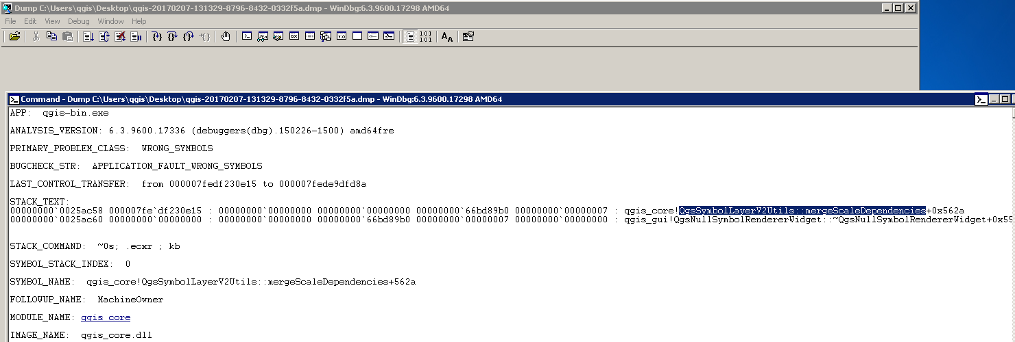
You can open these minidumps with a program like WinDbg to get an idea what caused the exception: enter image description here

We tried to find the reason for the exceptions when QGIS crashed quite often. Even with our paid QGIS-Support we could not find the reasons for the QGIS-crashes and were told that the minidumps are not necessarily helpful.

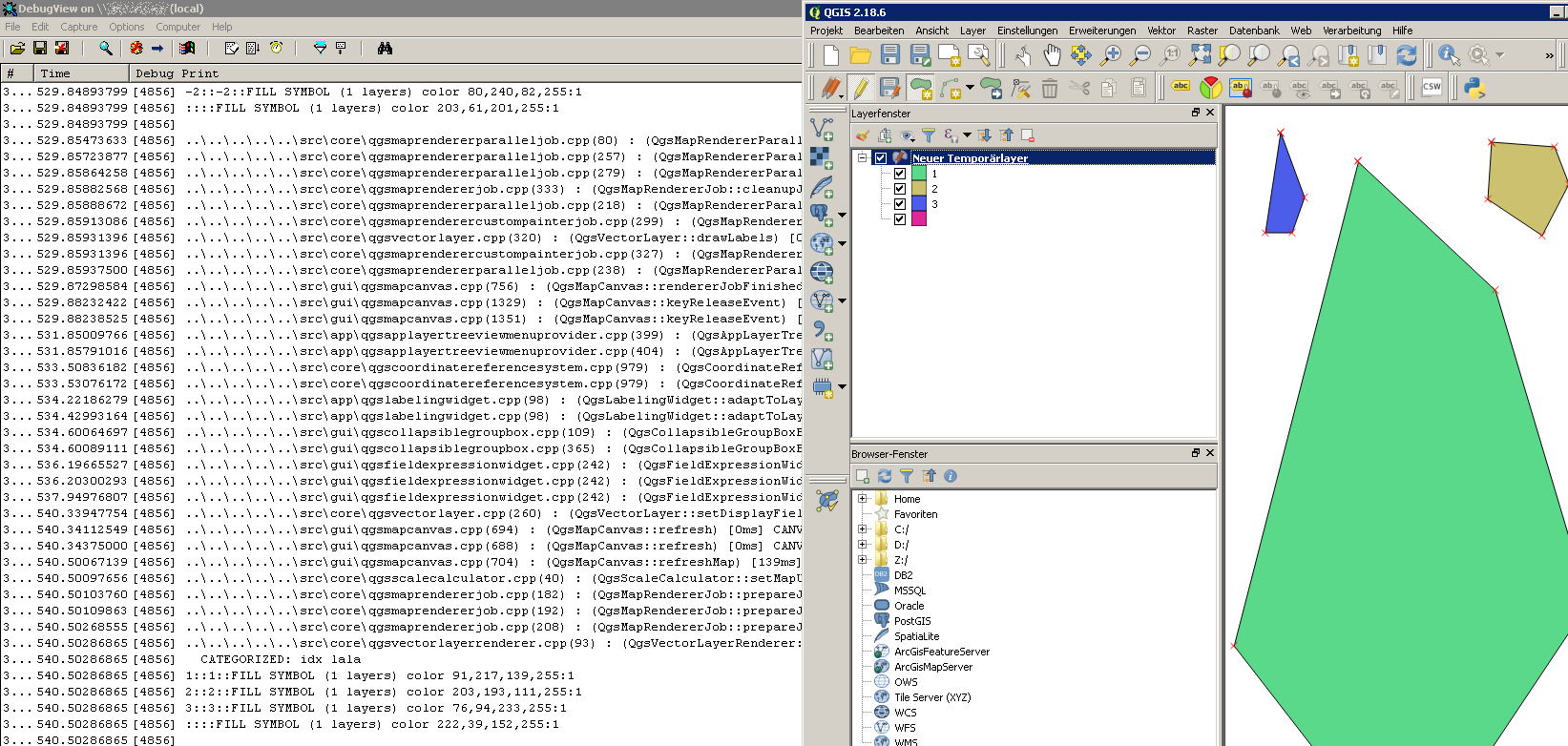
A better way for us was to use the QGIS-rel-dev version which writes debug-outputs and listen to these debug-outputs with a program like DebugView (https://technet.microsoft.com/en-us/sysinternals/debugview.aspx ):

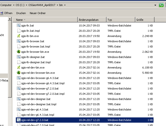
If you install qgis-rel-dev with the OsGeo4W-Installer you can start this QGIS-version with the qgis-rel-devXXX.bat file:

enter image description here

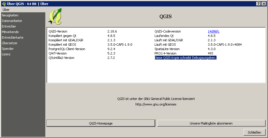
In the about-dialog of QGIS you can see if your QGIS-version writes debug outputs: enter image description here

If you start DebugView and work with QGIS until it crashes you should see what tools / functions were involved when the crash happened: enter image description here

1
  • Thanks. When I get a chance I shall get my head around your answer and let you know how I get on. Commented Apr 26, 2017 at 13:29
0

I discovered that a "corrupted" layer causes the "minidump crash" error. This corrupted layer contains some "invisible" features - I selected All Features (ctrl+A) then execute the Move Feature command, when I move the mouse, these invisible features appeared in a different shade of color, but it was there. So what I did is to re-create the layer by creating a new layer and then tracing the visible features. Then I deleted the "corrupted" layer from my project.

2
  • 1
    you could use vector - > geometry tools -> geometry validity, an you'll get the features causing the problem in an output layer, generally they are "phantom features" with entries in the dbf file but with no geometry Commented Feb 15, 2018 at 9:17
  • thanks, now i know how to properly address those features - "phantom" features... just new to qgis
    – chulee
    Commented Feb 19, 2018 at 0:35

Your Answer

By clicking “Post Your Answer”, you agree to our terms of service and acknowledge you have read our privacy policy.

Not the answer you're looking for? Browse other questions tagged or ask your own question.