Applying coordinate systems to datasets and using them within the coordinate system of a data frame can be confusing.
I think the way to sort it out is:
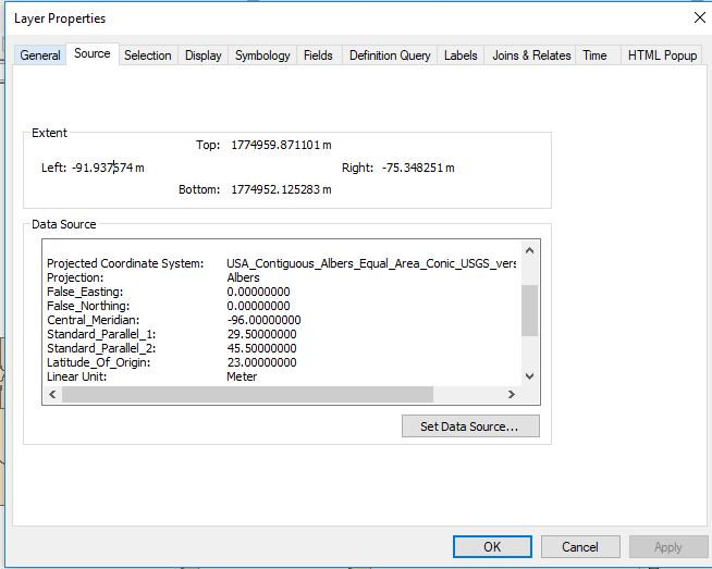
- Look at the Properties of each shapefile to see what coordinate range is present.
- If they are -180 < long < 180 and -90 < lat < 90 then they are in a Geographic Coordinate System and you use Define Projection to give it one.
- If they are much larger numbers (usually 6 or 7 digits) then they are in a Projected Coordinate System and you use Define Projection to give it one.
- If you want to display shapefiles in any coordinate system (as long as it has the correct coordinate system defined on it), in Albers Equal Area Conic, then set that as the coordinate system on your data frame.
- Add your shapefiles into that data frame and they will display in Albers Equal Area Conic, irrespective of the coordinate system(s) that they are stored in.
- If you want your shapefiles to be stored in a Projected Coordinate System, when they are currently correctly defined to be in a Geographic Coordinate System then, as a separate exercise, you can use the Project tool to project them.
Albers Equal Area Conic is a Projected Coordinate System.
Your question does not mention which, if any, Geographic Coordinate System your shapefile coordinates may be from.
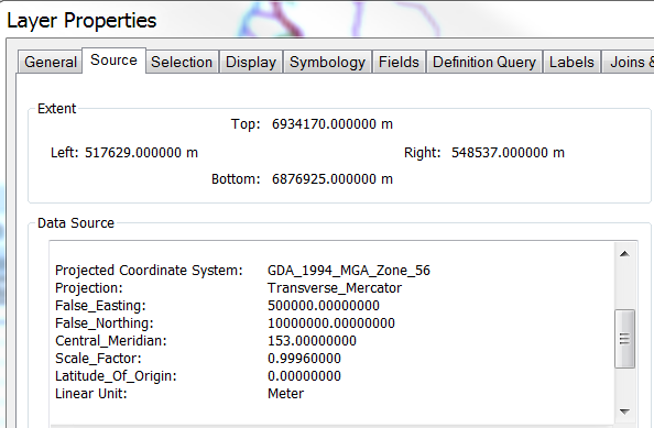
For all questions like this one I think it is important to show a screenshot from the Source tab of the Layer Properties like the one below. From it you can see the 6-7 digit numbers for the extent which is the range expected for a Projected Coordinate System. Then by scrolling down in the Data Source section you can see that it has a Projected Coordinate System of GDA_1994_MGA_Zone_56 defined on it.


